


Chapter 4: Using the Chart 49
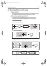
Once located, you can use the soft keys and trackpad to:
• Display detailed data for services at the listed ports.
• Show the selected item on the chart.
• GOTO the selected waypoint
• View tidal/current data for the selected tidal/current station.
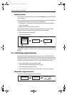
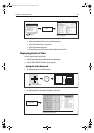
Displaying details of tides
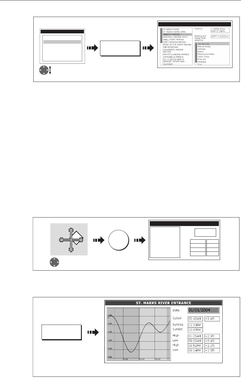
You can display details of tides by:
• Selecting the appropriate tidal diamond (see below) or
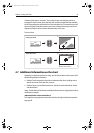
• Via the FIND NEAREST function (see
page 48
).
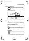
...Using the tidal diamond
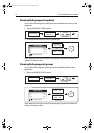
1. To display numerical tidal information:
You can now view additional tidal data.
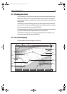
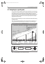
2. To display additional tidal data including a tidal curve:
D8310_1
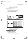
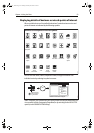
FIND
FIND NEAREST...
WAYPOINTS
PORT SERVICES
TIDE STATIONS
CURRENT STATIONS
WRECKS
OBSTRUCTIONS
P
ORTS
SELECT PORT
16 nearest to cursor in selected
category displayed.
Select required
category
T
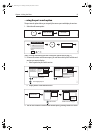
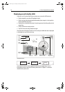
D8311_1
OK
Position cursor
over tidal diamond
OBJECT INFO
ST MARKS RIVER
High
Low
High
Low
Position
30
0
04.700N
84
0
10.700W
01:25AM +2.5ft
09:02AM +0.4ft
03:51AM +2.1ft
08:14AM +1.5ft
Tidal information displayed
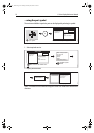
D6782_3
TIDAL DATA
Detailed data is shown for the selected time
(red, dashed, vertical line).
81221_4.book Page 49 Tuesday, February 28, 2006 5:24 PM