


190 C-Series Display Reference Manual
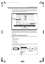
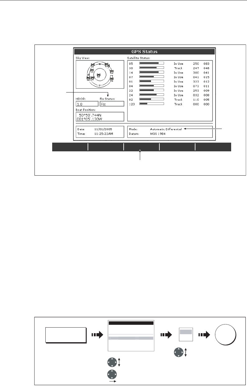
This screen provides, for each tracked satellite, the satellite number, a graphical signal
strength bar, status, azimuth angle and its elevation angle from your vessel. The sky
view graphic shows the position of these satellites.
Positional accuracy is dependent upon these parameters; in particular, the azimuth
and elevation angles are used in a triangulation process to calculate your position.
Horizontal Dilution of Position (HDOP) is a measure of this accuracy; a higher figure
signifies a greater positional error. In ideal circumstances, the figure should be in the
region of 1.0.
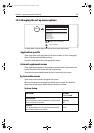
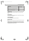
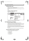
Selecting the satellite differential system
You should select the satellite group(s) appropriate to your area, via the Other Set Up
soft key:
• WAAS - United States
• EGNOS - Europe
• MSAS - Japan
•GAGAN - India
Note: The EGNOS, MSAS and GAGAN systems may not currently be active. Check with
your local government for operational status.
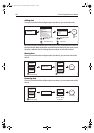
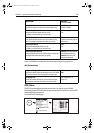
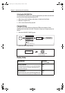
DIFF SET UP OTHER SET UP RESTART GPS
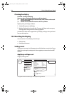
DIFF GPS
ON OFF
D6809_3
Actual mode
GPS reporting
(No Fix, Fix, D
Fix or SD Fix)
Mode
selected
by GPS
Only available if connected to
Raymarine landbased GPS e.g. 114
DIFF SET UP
D8715_1
GPS Setup Menu
Datus WGX 1984
COG/SOG Filter Medium
EGNOS OFF
MSAS OFF
GAGAN OFF
WAA
S
ON
Highlight satellite
group
Highlight
ON or OFF as
appropriate
Select group
OK
ON
OFF
OTHER SET UP
81221_4.book Page 190 Tuesday, February 28, 2006 5:24 PM