


2 C-Series Display Reference Manual
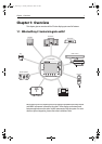
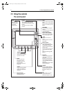
1.2 What can the C-Series Display do?
With the appropriate equipment connected to your system and the necessary data
available, your C-Series display combines the following applications which are used to:
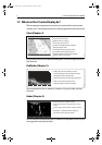
Chart (Chapter 4)
You will need a chart card, and position/heading data, for the chart application to be
fully functional.
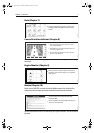
Fishfinder (Chapter 5)
You will need position data, in addition to a DSM250, for your fishfinder to be fully
functional.
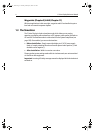
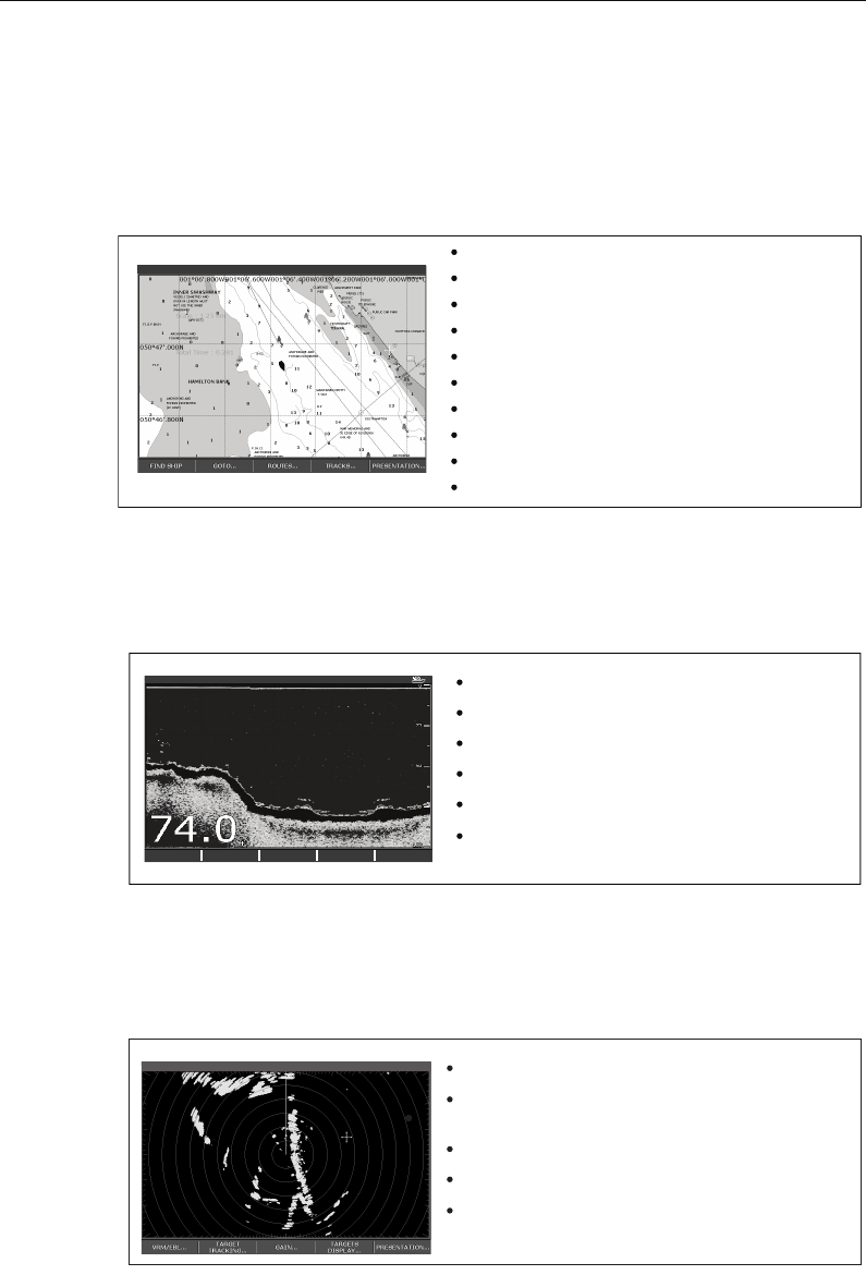
Radar (Chapter 6)
You will need position and heading data, in addition to a compatible scanner, for your
radar application to be fully functional.
0.5nm North-Up (Relative Motion) Local
D7363_2
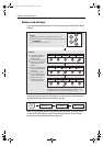
Locate where you are.
Interpret your surroundings.
Monitor where you are going.
Record where you have been.
Navigate to a specified position (waypoint).
Build and navigate routes.
View details of nearby features & services.
View details of boats equipped with AIS.
Distinguish between fixed and moving objects.
Measure distances and bearings.
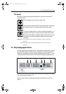
D7377-1
Build a picture of what is below your vessel.
Locate & distinguish underwater objects & targets.
Distinguish the seabed and its texture.
Obtain information about water depth, temperature.
Mark a point of interest, fishing spot etc.
Determine depths and distances of targets.
TRANSDUCER
SETTINGS…
ZOOM… BOTTOM LOCK… A-SCOPE… PRESENTATION…
200kHz: Auto Range: Auto
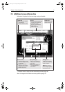
Detect landmasses & navigation markers.
Detect and measure the range and distance of other
vessels.
Acquire targets and track them for collision avoidance.
Navigate to a specified position (waypoint).
View details of boats equipped with AIS.
VRM/EBL... GAIN...
TARGETS
DISPLAY...
PRESENTATION...
TARGET
TRACKING...
6nm North-Up (Relative Motion) Rings 1nm
D7375-2
81221_4.book Page 2 Tuesday, February 28, 2006 5:24 PM