


9-1190-01004-03 Rev. B
Garmin GTN 625/635/650 Pilot’s Guide
Foreword
Getting
Started
Xpdr Ctrl
Com/Nav
FPL
Direct-To
Proc
Wpt Info
Map
Traffic
Terrain
Weather
Nearest
Music
Utilities
System
Messages
Symbols
Appendix
Index
9 TRAFFIC
9.1 Traffic Information Service (TIS) (Optional)
WARNING: The Traffic Information Service (TIS) is intended for advisory
use only. TIS is intended to help the pilot locate traffic visually. It is the
responsibility of the pilot to see and maneuver to avoid traffic.
NOTE: TIS is available only when the aircraft is within the service volume of
a TIS-capable terminal radar site. Aircraft without an operating transponder
are invisible to both Traffic Advisory Systems (TAS) and TIS. Aircraft without
altitude reporting capability are shown without altitude separation data
or climb descent indication.
NOTE: TIS and Traffic Advisory System (TAS) may not both be configured
at the same time.
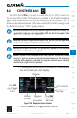
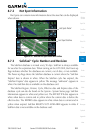
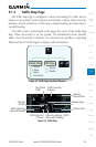
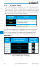
Traffic Information Service (TIS) is designed to help in detection and
avoidance of other aircraft. TIS uses the Mode S transponder for the traffic data
link. TIS receives traffic information from ground stations, and is updated every
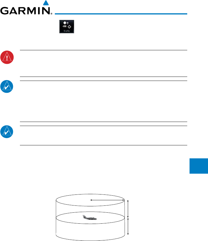
five seconds. The GTN 6XX displays up to eight traffic targets within a 7.5 NM
radius, from 3000 feet below to 3500 feet above the requesting aircraft.
7.0 nm
3,500 ft
3,000 ft
Figure 9-1 TIS Coverage Volume (not to scale)