


8-7
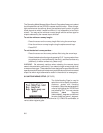
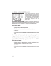
Select the desired distance, speed and altitude units by highlighting the
“NAV” field and pressing CLR. You may choose between nautical (nautical
miles/knots/feet), statute ( miles/miles per hour/feet), or metric (kilometers/
kilometers per hour/meters) units. (NOTE: The NAV units setting also
defines the pressure, temperature and vertical speed units that will be used
for E6-B calculations.)
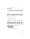
Heading information can be displayed referencing magnetic north
(automatically calculated or user-defined), referencing true north or referencing
calculated grid headings. Select the desired heading reference by highlighting
the “HDG” field and pressing CLR. When the “auto mag var[iation]” option
is selected, heading information will reference the automatically calculated
magnetic variation shown. For most applications, the “auto mag” feature will
provide accurate heading information. If the auto-magnetic variation is not
correct, you may define the magnetic variation by selecting “user mag var”.
If the “user mag var” option is selected, the magnetic variation is then
entered.
To enter a user-defined magnetic variation...
· Highlight the “HDG” field and select “User Mag Var” with CLR.
· Press the right arrow key.
· The variation direction is highlighted. To change the direction, press
CLR.
· Press ENT.
· Enter the variation degrees and press ENT.
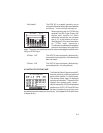
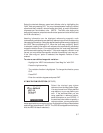
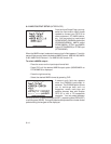
8.7 MAP DATUM SELECTION (SETUPS)
Select the desired map datum
reference from the Map Datum Page.
You may choose from 102 pre-defined
map datums, or you may define your
own. If the sectional/chart you are
using specifies a reference datum,
select that datum on your GPS 95. If
the sectional/chart does not specify a
reference datum, you may select each
datum applicable to your region until you find the datum that provides the best
positioning at a known point. (NOTE: The GPS 95 is shipped from the factory
with the WGS 84 datum selected.)