


5-5
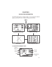
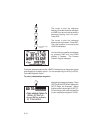
5.3 MAP CONFIGURATION
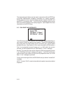
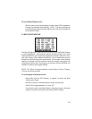
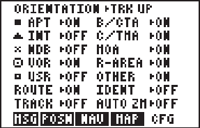
The Map Configuration Page allows you to tailor the GPS 95’s Map Display
to your preferences. As previously stated, the Map Display can show
airports, NAVAIDs, user waypoints, airspace boundaries, the active route,
your track history and/or waypoint identifiers. Any of these items may be
turned on or off according to your preferences. For example, when the Map
Display is zoomed out to its maximum levels the screen may appear too
cluttered to be easily read. In this case, you could turn off the information not
needed to create a more legible display.
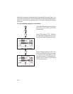
NOTE: The "Other" airspaces selection includes Alert, Caution, Danger,
Training and Warning areas.
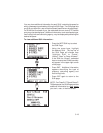
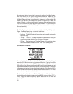
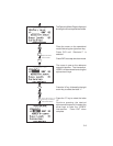
To turn display information on/off...
· Press NAV and the CFG softkey, if needed, to select the Map
Configuration Page.
· Place the cursor on the desired item using the arrow keys.
· Press CLR to toggle between “on” and “off”.
· If you wish to return to the Map Display: place the cursor on the page
options using the arrow keys, then press the MAP softkey.
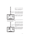
To set the Map Display scale...
· With the cursor on the scale setting number, press CLR to sequence
through the available scale settings. (HINT: The scale setting may
also be selected by pressing the alphanumeric key that corresponds
to the desired scale.)