


5-6
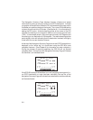
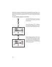
An auto zoom feature is provided for automatic scaling of the Map Display.
With this feature on, the scale setting will automatically adjust as you
approach your destination. Starting at 80 nautical miles during en route flight,
the Map Display will zoom in progressively, stopping at a one nautical mile
scale as you arrive at your destination. (When navigating via a route, the
scale will begin at a maximum 80 nautical miles en route setting and zoom
in to one nautical mile at each waypoint along the route. As you cross over
each interim waypoint, the Map Display will zoom back out to no more than
80 mautical miles.)
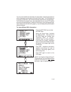
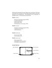
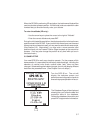
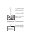
The Map Display orientation is also selected from the Map Configuration
Page. The Map Display may be oriented as follows:
· North up - The Map Display will always be displayed with north as the
top of the page.
· TRK up - Track up. The Map Display will be oriented such that your
current ground track direction is at the top of the page.
· DTK up - Desired track up. The Map Display will be oriented along
the course between the “active from” and “active to” waypoints.
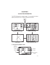
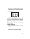
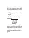
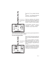
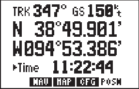
5.4 PRESENT POSITION
As mentioned earlier, the Present Position Page is automatically displayed
when the GPS 95 is turned on and a position is obtained. The top line of this
page displays your ground track (TRK) and ground speed (GS). The next two
lines indicate your current position according to the coordinate format and
map datum selected. In the example shown above, the position is displayed
in degrees and decimal minutes of latitude/longitude. (See Section 8.6 for
more information on coordinate format selections and Section 8.7 for more
information on map datum selections.)
The bottom line of the Present Position Page is a cyclic field which can
display either altitude above mean sea level (MSL) or current time (UTC or
local). Select the desired option by placing the cursor on this field and
pressing CLR.