


5-2
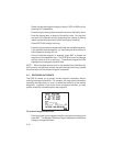
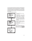
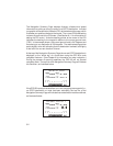
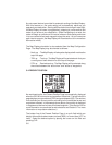
The Navigation Summary Page displays direction, distance and speed
information to guide you along a route or to a GOTO destination. Included
is a graphic course deviation indicator (CDI), at the bottom of the page, which
illustrates your position relative to the course. The current CDI scale setting
is shown at each end of the CDI scale. (See Section 8.11 for information on
setting the CDI scale.) A relative bearing pointer at the center of the CDI
indicates the bearing to the waypoint relative to the current ground track
(TRK). In the example shown, the current ground track is 347 degrees and
the bearing to our destination is 339 degrees. The relative bearing pointer
points slightly to the left indicating that our destination is ahead, but slightly
to the left of our current direction of travel.
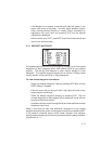
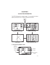
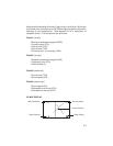
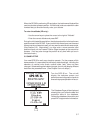
At the top of the Navigation Summary Page the current GOTO destination is
displayed, or the “active leg” of a route when using the GPS 95’s route
navigation features. (See Chapter 6 for information on route navigation.)
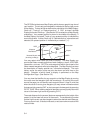
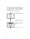
During the process of acquiring satellites, the GPS 95 will not provide
navigation data. The top line of the Navigation Summary Page will indicate
this condition, as illustrated below.
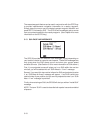
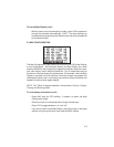
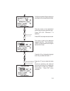
If the GPS 95 has acquired satellites, but is not navigating to a waypoint (i.e.,
no GOTO destination or route has been activated), the top line of the
Navigation Summary Page will indicate that no destination has been defined,
as illustrated below.