


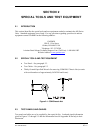


400 SERIES MAINTENANCE MANUAL Page 1-3
P/N 190-00140-05 Rev. C
Each of the configurations includes a color display providing graphical moving map capability.
Navigation, communication, and mapping functions are supported by a navigation database
provided by a removable database card. The mapping function has additional support provided
by a built-in ground features base map which may be supplemented by a detailed map provided
on a second removable database card.
Information relative to the installation and operation of the 400 Series is found in the 400 Series
Installation Manual, P/N 190-00140-02.
1.2 FUNCTIONAL SUMMARY
1.2.1 GPS 400
ƒ Position and velocity determination using signals transmitted by Global Positioning
System (GPS) Satellites.
ƒ Display of the stored navigation and map database for use by the pilot/flight crew.
ƒ Area navigation functions using the determined position/velocity and stored
navigation data.
ƒ Approach navigation functions and the associated database.
ƒ Interfacing with other flight instruments such as a moving map, autopilot, CDI/HSI
(including OBS), indicators, altitude encoder/serializer, fuel management system, and
annunciators.
ƒ 14 or 28 volt operation.
1.2.2 GNC 420
ƒ Performs all functions of a GPS 400.
ƒ Communications transceiver tuning from 118.000 to 136.9916 MHz in 25 kHz or
8.33 kHz increments.
ƒ Com audio output.
ƒ 10 or 16-watt transmitter.
ƒ 14 or 28 volt operation for 10 watt transmitter;
28 V only for 16 watt transmitter.
1.2.3 GNS 430
ƒ Performs all functions of a GNC 420.
ƒ VOR and ILS Localizer Receivers.
ƒ ILS Glideslope Receiver.