


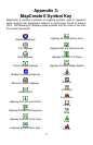
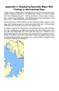

Appendix 4: Displaying Specialty Maps With
Fishing or Aeronautical Data
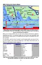
A new feature in MapCreate 6.3 allows you to view LEI's special fishing or
aviation mapping products on the MapCreate screen. The feature works
with Inland Mapping System™ Fishing Hot Spots
®
fishing maps or Jeppe-
sen
®
Americas and Jeppesen
®
International aeronautical databases, along
with the LEI
®
Obstructions aeronautical database.
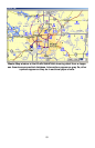
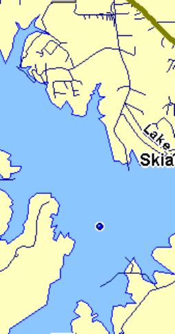
Showing fishing or aviation details on the computer makes it easier to plan
trips and manage waypoints, routes and other GPS data. All MapCreate
GPS data tools work just as they do with regular maps.
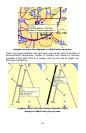
To display a special LEI map product, just place the memory card containing
the map or database in the MMC card reader, then launch MapCreate. (You
can also start MapCreate first, then insert the card.) In a moment or two,
MapCreate begins to read the map on the card, and the hourglass symbol is
shown in the lower left corner of the screen. While the special map is read,
the Master Map window may go blank for a moment before it reappears with
the special mapping data displayed.