


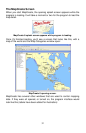
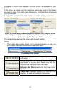
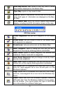

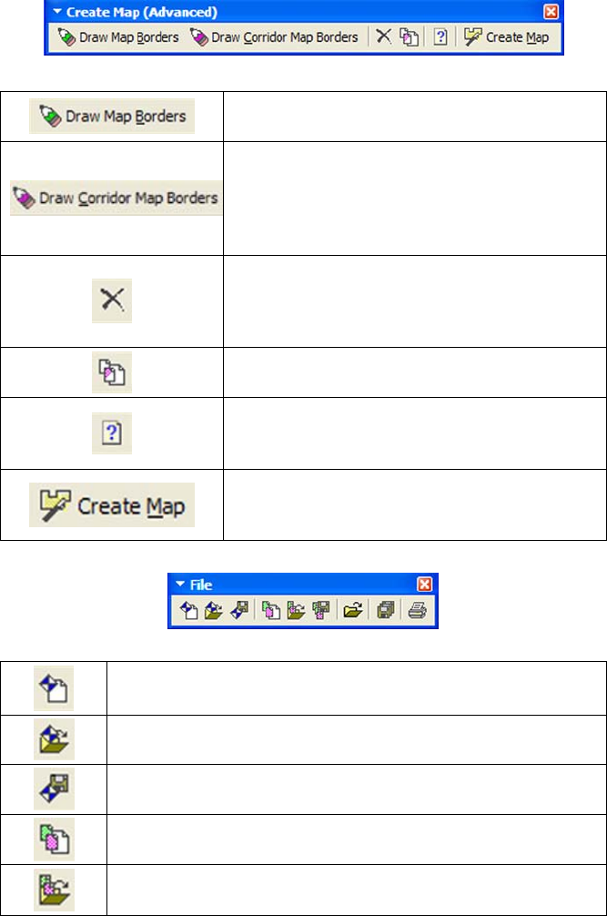
Create Map (Advanced) toolbar
Draw Map Borders: draws map borders as
green rectangles.
Draw Corridor Map Borders: draws irregu-
larly-shaped magenta corridor borders. Use-
ful for areas that don't fit neatly into rectangle
borders, or for making strip maps that follow
cross-country routes.
Delete Map Border: clicking anywhere on a
green map border or repeatedly clicking the
handle boxes of a magenta map border with
this tool removes the border from your map.
Clear Map Border: lets you clear or erase
all map borders displayed on the map.
Estimate Map Size: calculates an estimate
of the final file size of your map based on the
current map borders.
Create Map: creates a map file your GPS
unit can use from an area defined by a map
border.
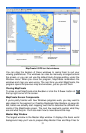
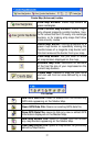
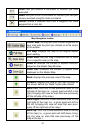
File toolbar
New GPS Data File: clears or erases from the screen any
GPS data appearing on the Master Map.
Open GPS Data File: Opens an existing GPS data file.
Save GPS Data File: saves to disk any new or edited GPS
information displayed on the Master Map.
New Map Border File: clears or erases from the screen
any map borders appearing on the Master Map.
Open Map Border File: opens a map border file previously
saved by MapCreate.
37