


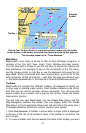
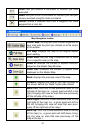

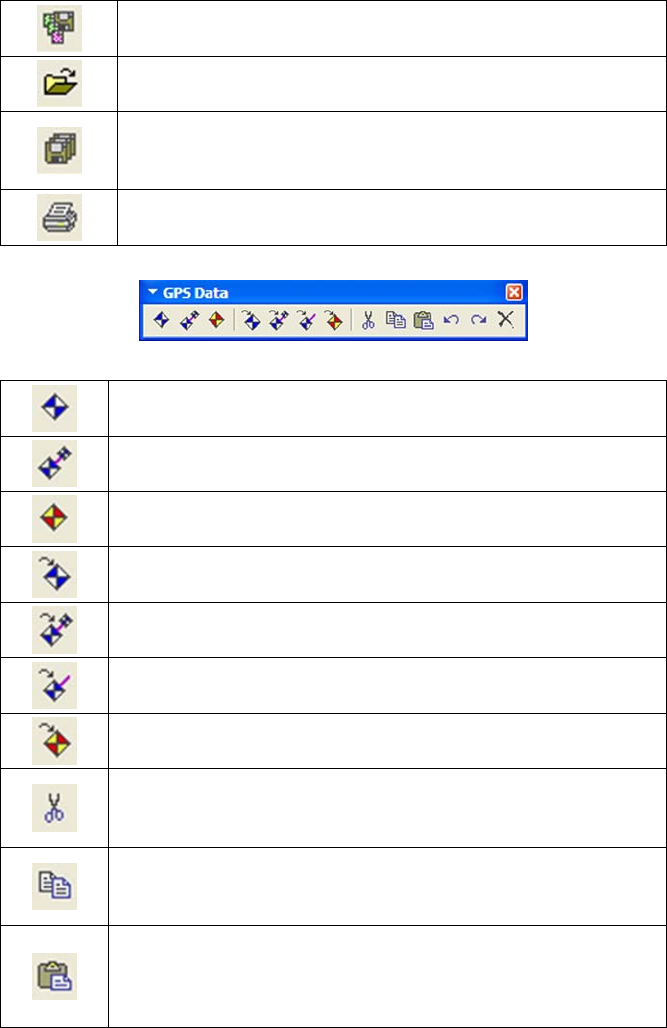
Save Map Border File: saves to disk any new or edited
map borders displayed on the Master Map.
Open Map: opens a map saved to disk.
Save All: saves a map border file and then a GPS data file,
when both types of information are displayed on the Mas-
ter Map.
Print Master Map: prints the current Master Map window
display, including any GPS information shown on the map.
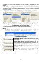
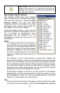
GPS Data toolbar
Create Waypoints: lets you set a waypoint on the Master
Map.
Create Route: lets you create a route on the Master Map,
with waypoints in a sequence.
Create Icons: Lets you set an icon on the Master Map.
Insert Waypoint: opens a dialog box that lets you set a
waypoint on the map by entering position coordinates.
Insert Route: opens a Route Waypoint List window and
creates an "empty" route with no waypoints.
Insert Route Waypoints: lets you change a route by insert-
ing new route waypoints.
Insert Icon: opens a dialog box that lets you set an event
marker icon on the map by entering position coordinates.
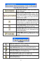
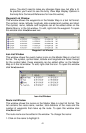
Cut: deletes text or a selected GPS data item from a way-
point list, route waypoint list or icon list and puts it in the
Windows clipboard.
Copy: copies text or a selected GPS data item from a way-
point list, route waypoint list or icon list to the Windows clip-
board.
Paste: inserts text from the Windows clipboard. Inserts a
GPS data item from the Windows clipboard into its respec-
tive list window. (You cannot paste one type of GPS data
into a list window for a different data type.)
38