


76
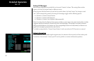
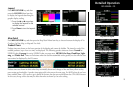
Detailed Operation
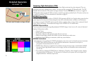
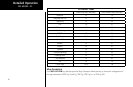
FIS Product Times
Goes Blue After (Minutes) Goes Yellow After (Minutes)
NEXRAD 8 13
Graphical METAR 15 75
Lightning 8 23
TFR 15 51
Cell Movement 4.25 5.5
Radar Coverage 8 13
METAR 15 75
Echo Tops 10.5 18
Winds Aloft 15 75
AIRMET 15 51
SIGMET 15 51
Cyclone 15 51
County Warnings 8 23
Freezing Level 15 75
City Forecasts 15 51
TAF 15 75
Cloud Tops 10.5 18
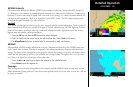
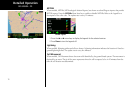
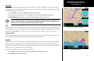
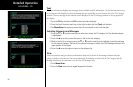
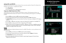
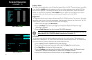
Map Orientation
Press MENU/ENTER key and then press the Map Orientation Menu Item key to choose the configuration of
the map orientation of DTK Up, North Up, TRK Up, TRK Up Arc, or TRK Up 360.
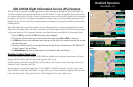
GDL 69/69A - FIS