


90
Detailed Operation
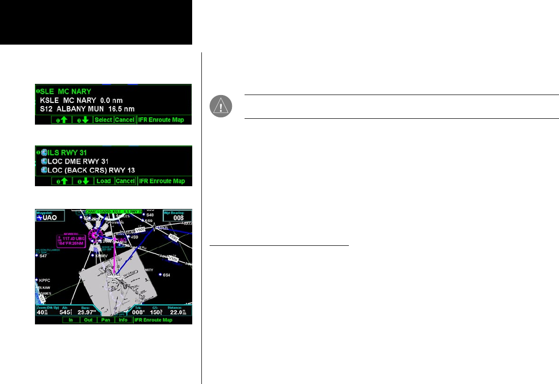
Loading the Approach Chart
Once the airport is selected, the individual approach chart to be overlaid can be loaded from a list of geo-ref-
erenced approach charts available for that airport. Not all approach charts can be overlaid in this fashion and
only geo-referenced charts will be presented for selection from the Custom Map. Because of this, it is possible
that approach charts that are viewable under the Chart View Function may not be presented in this list.
NOTE: The pilot must be aware that not all charts in the loaded database can be used as an
overlay.
Once the approach chart is loaded, a green Annunciator will illuminate at the top of the screen indicating the
airport name and specific chart that has been loaded.
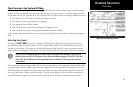
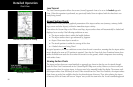
Overlay Chart Loading Example
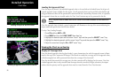
1. Press FN and then MAP or IFR.
2. Press MENU and then the LOAD CHART Menu Item key.
3. Highlight the desired airport with the arrow “smart” keys and then press the SELECT “smart” key.
4. Highlight the desired approach with the arrow “smart” keys and then press the LOAD “smart” key.
5. Adjust the zoom level using the IN or OUT “smart” keys.
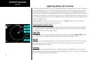
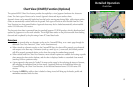
Viewing the Chart as an Overlay
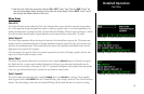
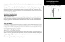
Display of Coverage Area
Once the desired approach chart has been loaded, a green Annunciator bar with the approach name is illumi-
nated at the top of the Custom and IFR maps. If the aircraft is outside the coverage area of the approach chart,
a black rectangular box will be presented that shows the coverage of the chart itself.
Once the aircraft has entered the coverage area, the chart contents will be displayed on the screen. Note that
a loaded approach chart is only viewable from the maps when the aircraft is in flight, otherwise, the airport
surface chart has priority and the approach chart must be viewed from the Chart View function.
Chart View
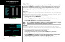
Selecting an Airport in the IFR Function
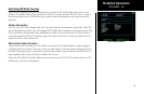
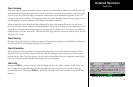
Selecting an Approach Chart in the IFR Function
Selecting an Approach Chart in the IFR Function