


14
Getting Started
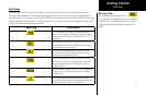
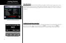
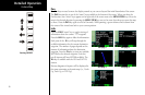
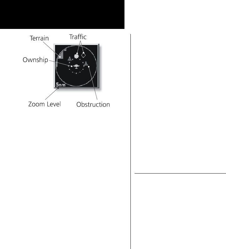
Traffic on Thumbnail
TIS, TAS, or TCAS traffic is shown on the Thumbnail in the same symbology used within the Traffic Function. ADS-
B traffic is not shown on the Thumbnail. Any traffic within sensor range and 5 nm is shown, in addition to traffic
causing an amber Traffic Alert (TA) traffic. Note that the MX20 supports one traffic sensor in any installation.
Terrain on the Thumbnail
Only “Red” terrain within the 5 nm range is presented on the Thumbnail. This correlates directly to terrain that
is rendered in red on the normal Terrain Function based on the internal terrain database. External TAWS-based
terrain from the Goodrich Landmark is not shown on the Thumbnail.
Obstructions on the Thumbnail
Only “Red” obstructions within the 5 nm range are presented on the Thumbnail. This correlates directly to
obstructions that are rendered in red on the other functions.
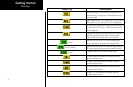
Thumbnail Activation
The Thumbnail incorporates logic that will either show or hide the thumbnail from view. It will only be shown
when there is data to be presented and will be removed if not. For example, if there is no “Red” terrain or traffic
within 5 nm, the Thumbnail will be hidden from view. The Thumbnail will not appear on the Traffic Func-
tion page if only traffic is presented in the Thumbnail. Correspondingly, it is not shown on the Terrain page if
only terrain is presented in the Thumbnail. This logic eliminates redundant views that would be created by the
Thumbnail and normal views of traffic and terrain. Additionally, the Thumbnail is disabled while operating on
the ground. This state is determined by the “En Route/Ground Transition Speed” set in the System Function
page and is based on GPS ground speed.
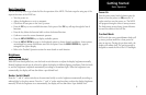
Traffic Information Services (TIS)
There are two versions of TIS: TIS-A and TIS-B. Both are described below.
In the TIS-A system, ground radar sensors collect target information. The ground radar sensor then determines
the targets in the vicinity of your aircraft and their bearing relative to your track. Up to eight of the targets are
transmitted by the ground radar sensor the next time it communicates with your TIS-A enabled transponder.
In the TIS-B system, the ground radar sensors collect target information much the same as in the TIS-A system.
However, with TIS-B, all targets collected by the ground radar sensor are broadcast to all aircraft equipped with
UAT data link radios and that are within coverage of UAT ground broadcast stations.
Thumbnail and TIS
Thumbnail view of conflicting terrain and traffic