


46
Detailed Operation
clearance based on TIS-B displayed cockpit information must be approved by the controlling
ATC facility prior to commencing the maneuver. Uncoordinated deviations may place an aircraft
in close proximity to other aircraft under ATC control not seen on the airborne equipment, and
may result in a pilot deviation.
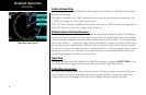
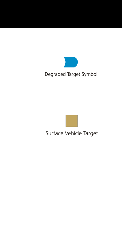
Degraded Target
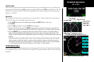
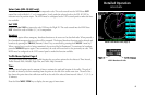
Degraded targets are shown with the “bullet” symbol. A degraded target has limited positional accuracy and
can either be an uplinked TIS-based target, or an ADS-B target who’s GPS position has degraded. When a
degraded target is selected via the SELECT key in the Traffic function, no distance to the target is displayed, as
it cannot be computed accurately.
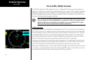
Surface Targets
Surface vehicle targets, in addition to ADS-B targets, are supported and are shown as tan, rectangular ICONs.
They are displayed both on the Traffic Function page, and on the Custom Map when traffic is turned on.
Target Color
Service vehicle targets are colored in tan. Aircraft targets are cyan in color. Selected targets are green in color.
Traffic Altitude Values
Altitudes shown next to the traffic icon are in hundreds of feet (09 = 900 feet). Altitude values shown in all
other locations and displays are the actual values in feet (+100 = 100 feet).
Ident (GDL 90 UAT only)
The IDENT smart key allows the pilot to initiate a sequence that is equivalent to a standard transponder “Ident,” as
requested by ATC. When pressed, the Ident flag will be displayed while the GDL 90 UAT broadcasts the ident. The
MX20 must be configured to be the UAT’s control panel for this function to be available.
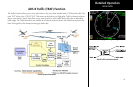
ADS-B Traffic