


57
Detailed Operation
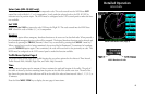
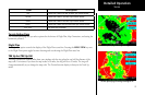
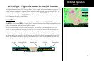
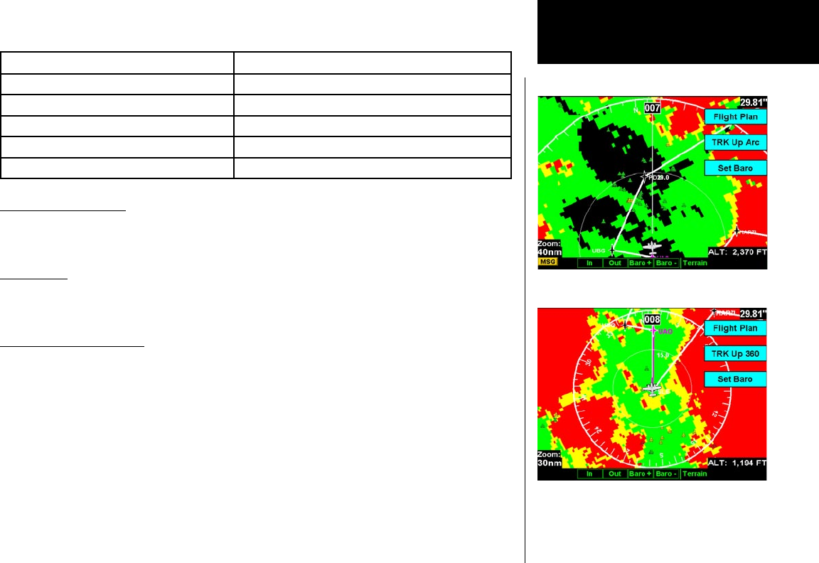
Terrain
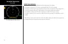
Color Description
RED Terrain that is within 500 feet, or above, your current altitude
YELLOW Terrain that is within 1000 feet of your current altitude
GREEN Terrain that is within 2000 feet of your current altitude
BLACK Terrain that is more than 2000 feet below your current altitude
LIGHT BLUE No terrain data is available
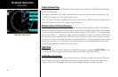
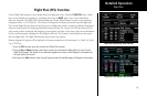
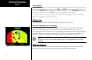
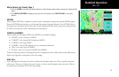
Terrain Option Page
The Terrain option page lets you select options for the choices of Flight Plan, Map Orientation, and setting the
barometric pressure.
Flight Plan
The Flight Plan option controls the display of the Flight Plan course line. Pressing the MENU ITEM key next
to the Flight Plan option toggles between showing and not showing the Flight Plan route line.
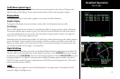
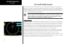
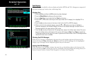
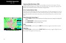
TRK Up Arc/TRK Up 360
This ring is marked in nautical miles from your airplane with the ring placed at one half the distance of the
map scale. For instance if you have the map scales at 50 miles, the ring will be at 25 miles. The ring will
change automatically as you change the map scale. The Terrain function display is always in the Track Up
mode.
Terrain option page showing 120 degree arc
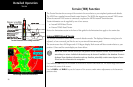
Terrain option page showing 360 degree arc