


61
Detailed Operation
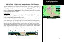
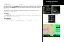
WSI InFlight™ Flight Information Service (FIS) Function
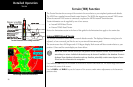
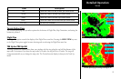
The Flight Information Service (FIS) Function allows access to graphic and text weather data messages on WSI
InFlight-equipped installations. Graphical weather includes US and Canadian radar, METARs, and TAFs. You
can select Graphical WX, Text, or Status information by pressing the MENU/ENTER key and then choosing
the type of information with the MENU ITEM keys. Review the Limitations section in the front of this guide
for the limitations that apply to the FIS data.
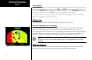
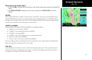
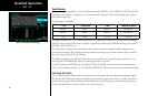
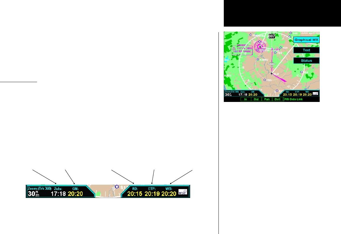
Product Times
Product times shown on the lower portion of the display are: GM for Graphical METARs, RD for weather
radar, ETP for EchoTops, and WB for Warning Boxes. Times are Zulu times when the data was assembled on the
ground, not the time the data was received by the FIS sensor.
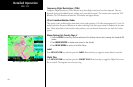
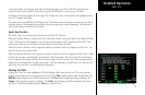
For MX20s that have any GPS receiver that provides time, the Zulu time is the time reported by the GPS
receiver. For MX20s that do not have time provided by a GPS receiver, this field is invalid and dashed out.
Product times are shown in white when they are 0 to 5 minutes old, gray when they are 5 to 10 minutes old,
and yellow when they are older than 10 minutes. For MX20s that have time available from a GPS receiver,
age is based on the time reported by the GPS receiver. For MX20s that do not have time available from a GPS
receiver, age is based on the time the data was received from the FIS sensor. In this case, the age of the data
may be older than what is shown by the color coding.
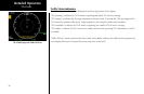
WSI - FIS
WSI FIS Graphic Weather Info
WSI FIS Graphic Weather Product Times
Zulu Time Graphical METARs Weather Radar Echo Tops Warning Boxes