


88
Detailed Operation
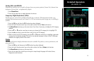
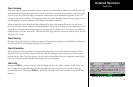
Chart Data Source
The same set of charts that are available in electronic form from the Jeppesen JeppView™ product are available
for loading onto the MX20 platform. These consist of approaches, SIDS, STARS, airspace charts, and airport
surface diagrams. The MX20 can display all of these charts from the Chart View Function, or a more limited
sub-set as dynamic overlays on the “Custom Map” when the corresponding chart has been “Geo-Referenced”
by Jeppesen.
Data Card
As there are more charts available from Jeppesen than will fit on the physical data card, predetermined cover-
age areas are loaded instead of the entire contents of the Jeppesen CD ROM. This process is performed using
the data loader software tool provided by Jeppesen. The MX20 Chart View data card can hold approximately
10,000 charts at a given time.
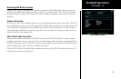
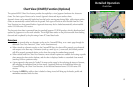
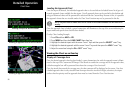
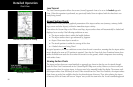
Chart Geo-Referencing
For the ownship position to be overlaid on the chart (as viewed from the Custom/IFR Map), the chart must
be available in a “Geo-Referenced” version, as supplied by Jeppesen. “Geo-Referenced” is the term used to
indicate charts whose features have associated latitudes and longitudes, allowing them to be drawn over other
geographical data, such as maps. Currently not all charts and airport surface charts are geo-referenced.
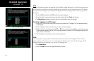
When a chart is viewed and a red “X” is present on the earth symbol (to the left of the chart name), the chart is
NOT geo-referenced and thus cannot be “loaded.”
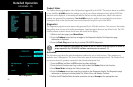
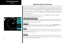
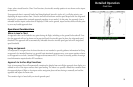
Chart View