


28
Detailed Operation
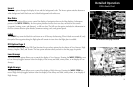
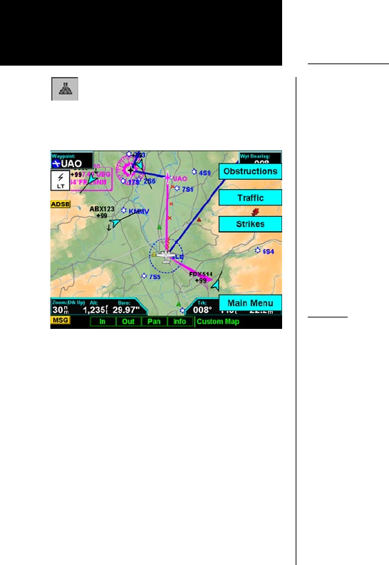
Obstructions
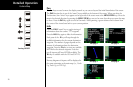
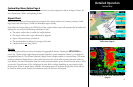
Obstructions, such as towers and other man-made objects, are part of the MX20 updateable database. Obstruc-
tions over 250 feet high are shown on the maps with tower symbols. The symbol is color coded to signify the
relative altitude of the tower to your aircraft’s altitude and follows the same conventions as the color coding
for terrain. Objects that are at your altitude are shown in red; objects that are near your altitude are shown in
yellow; objects with towers that are significantly below your altitude colored green. Obstructions are shown
on the Custom Map and in the Terrain function. For info on color coding, see the section about the Internal
MX20-Based Terrain. Review the Limitations section in the front of this guide.
Current coverage for obstructions is North America only and are drawn only when the zoom level is below
50 nm.
Traffic
The Traffic option turns the display of traffic information on or off. ADS-B Traffic information includes the
location and identifier of a reporting aircraft, its direction of travel, elevation, and the estimated path for the
selected time interval. See the section on the Traffic mode for more details on how traffic information is used.
For Skywatch/TCAD/GTX 330 installations, a small thumbnail presentation of traffic is presented in the upper
left corner of the display. In TCAD, Skywatch, and GTX 330 installations, the traffic targets can also be overlaid
on the Custom Map page.
The Traffic function is not available in all software versions. Check your Approved Flight Manual Supplement
to verify if this feature is available. Review the Limitations section in the front of this guide.
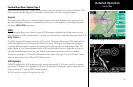
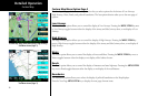
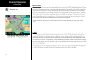
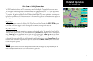
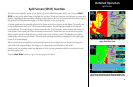
Custom Map
Custom Map page with Obstructions, Traffic,
Lightning Strikes, and Menu Items (Page 4)
Obstruction icon