


5
Getting Started
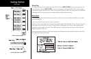
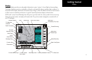
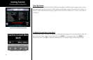
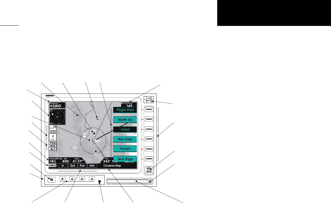
Display
The MX20 display provides text and graphic information to give a “picture” of your flight and surroundings.
The display brightness may be set manually or allowed to automatically adjust to ambient light conditions. At
the bottom of the display, labels above the function keys change to show the different choices for each function
to allow access to commonly used actions. A typical Custom Map function display is shown below.
MX20s with a rotary Power/Dimming knob will go into a pre-heat mode for a short period of time on start-up.
During the pre-heat mode, the display will remain dark. The pre-heat mode is designed to extend the life of
the LCD backlight.
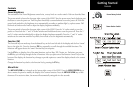
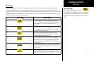
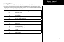
MX20
Power/Dimming
Graphic Display
Menu Item
Smart Keys
Menu/Enter Key
Data Card Ejector
Data Card
Function Smart Keys
Function Key
Function Smart
Key Labels
Currently Selected Function
Mounting Screw
Advisory Flags
Message Flag
Zoom
(Map Scale)
TO Waypoint
Identifier
Bearing to
Destination (TO) Wpt
Menu Item Labels
Data Flags
Photosensor
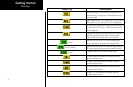
Ownship
Traffic
Traffic Thumbnail
Obstruction
Display