


56
Detailed Operation
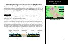
Terrain (TER) Function
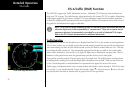
The Terrain Function shows a map of the terrain in the area relative to your airplane’s position and altitude.
The MX20 has a standard internal based terrain function. The MX20 also supports an external TAWS sensor.
When the external TAWS sensor is connected, it replaces the MX20’s internal Terrain function.
Terrain information can be supplied by one of two sources:
• Internal MX20-Based Terrain
• External TAWS-Based Terrain
Review the Limitations section in the front of this guide for the limitations that apply to the terrain data.
Internal MX20-Based Terrain
The altitude information comes from an external altitude encoder. The displayed altimeter setting has to be
adjusted, or baro-corrected, just like the one in your aircraft’s instrument panel.
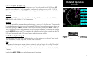
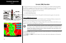
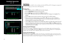
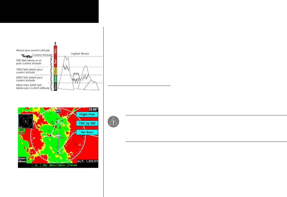
The terrain screen has a 360-degree and a 120-degree display. Both screens will show terrain relative to your
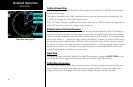
position. Colors used for terrain display are shown below.
NOTE: The Terrain function shows you the general terrain elevations relative to your altitude and
are advisory in nature. Individual obstructions may be shown if available in the database. Terrain is
displayed from database information and may therefore potentially contain some degree of error.
Do not use this information for navigation.
Use the IN and OUT keys at the bottom of the screen to zoom in and zoom out. The zoom range is shown in
the lower left corner of the screen.
Use the BARO+ and BARO- keys at the bottom of the screen to make minor adjustments to the barometric
pressure value.
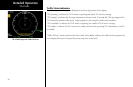
Terrain
Terrain Page with MX20-Based Data
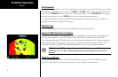
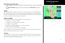
Terrain Elevation Color Coding Reference