


69
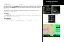
Detailed Operation
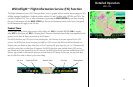
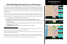
GDL 69/69A Flight Information Service (FIS) Function
The FIS Function is capable of displaying graphical weather information through the XM Satellite Radio Ser-
vice when activated in the optional installation of the GDL 69/69A. A variety of graphical data can be overlaid
on the map at the touch of a button. Review the Limitations section in the front of this guide for the limitations
that apply to the FIS data. To minimize the possibility of display clutter, up to four weather products may be
displayed at any one time. When four weather products are displayed, you must first disable a product before
enabling another.
XM Satellite Radio offers several subscriptions, that are differentiated by the products provided with each level.
Refer to the XM Satellite Radio web site for a description of the subscription options. The MX20 provides options
via the menu item keys for all supported functions, even those that are not available for all subscription levels.
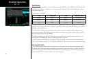
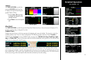
1. Press the FN key and then the FIS function key when displayed.
2. The first two function smart keys at the bottom of the screen zoom IN and OUT on the map.
3. The PAN key brings up the movement menu item keys at the right of the screen that allow you to move
the view of the map.
4. The fourth function smart key on the right will step through the four sub-functions of GDL 69/69A FIS:
Current, Forecast, Text, and Status.
5. The Menu/Enter key brings up menu items for more detail on each sub-function.
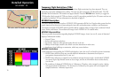
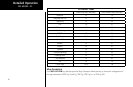
Weather Product Zoom Scale
The weather products available using the GDL 69/69A are divided into two classes: those drawn at all zoom
settings and those drawn when the zoom scale is greater than 15 nm.
Products shown at all zoom levels: METARs, Cell Movement, City Forecast, County Warnings, Cyclones (or
Hurricane Track), Lightning, and TFRs.
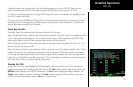
Products shown at zoom levels greater than 15 nm: AIRMETs, SIGMETs, Freezing Level, Echo Tops, Cloud
Tops, NEXRAD, Winds Aloft, and (Radar) Coverage. When any of these products are displayed and the zoom
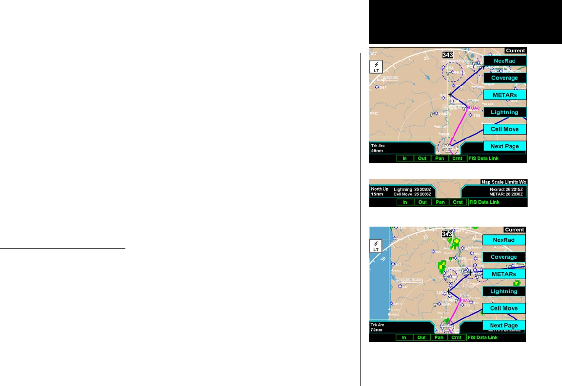
level is less than 20 nm, “Map Scale Limts Wx” will be displayed in the lower right corner.
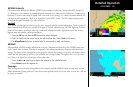
GDL 69/69A - FIS
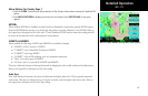
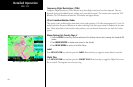
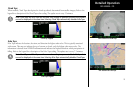
GDL 69/69A FIS Menu Page 1
GDL 69/69A FIS Menu Page 1 with NEXRAD Activated
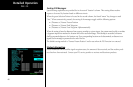
Weather in Current Function Limited to 20 nm or
more