


96/96C Owner’s Manual 79
MaIn paGeS >
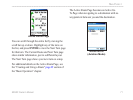
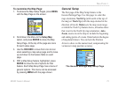
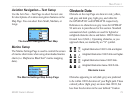
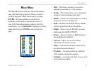
Aviation Navigation—Text Setup
Use the Avtn Nav—Text Page to select the text size
for descriptions of aviation navigation features on the
Map Page. You can select from Small, Medium, or
Large.
The Aviation Navigation—Text Map
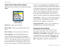
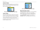
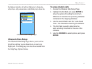
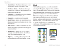
Marine Setup
The Marine Settings Page is used to control the screen
of marine chart items when using downloaded marine
charts (i.e. MapSource BlueChart
®
marine mapping
data).
The Marine Settings Map Setup Page
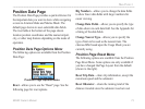
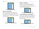
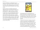
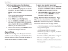
Obstacle Data
Obstacle on the map Page are shown in red, yellow,
and gray and dark gray, light gray, and white for
the GPSMAP 96C and GPSMAP 96 respectively.
References to obstacle icon gray tones for GPSMAP
96 units are in parentheses for this section. Standard
aeronautical chart symbols are used for lighted or
unlighted obstacles above and below 1000 ft Above
Ground Level (AGL). Upcoming obstacles, as you
approach them, are marked by an “X” symbol.
Lighted Obstruction 1000 ft. AGL and higher.
Unlighted Obstruction 1000 ft AGL and higher.
Lighted Obstruction below 1000 ft AGL .
Unlighted Obstruction below 1000 ft AGL.
Obstacle Icons
Obstacles appearing in red (dark gray) are predicted
to be within 100 ft elevation of your flight path. Those
colored yellow (light gray) are more than 100 ft, but
less than the elevation in the user dened “Caution