


62 96/96C Owner’s Manual
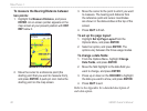
MaIn paGeS >
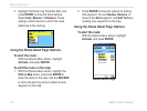
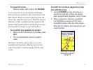
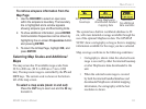
To view additional details about an on-
screen waypoint or map item:
1. With the waypoint or map item highlighted,
press ENTER.
2. If the item is a waypoint, a Waypoint
Information Page appears, showing details
such as name, symbol, coordinates, elevation,
and depth. The on-screen buttons Delete,
Map, or Go To appear. Select an on-screen
button and press ENTER, or press QUIT to
exit the Waypoint Information Page.
If the item is a map feature, an Information
Page appears, showing details about the
feature. The on-screen buttons Delete, Map,
or Go To appear. Select an on-screen button
and press ENTER, or press QUIT to exit the
Waypoint Information Page.
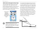
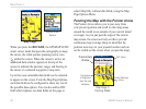
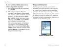
Airspace Information
The Panning mode can also be used to retrieve
information on airspaces depicted on the map. Once
the Pointer Arrow is placed on an open area within
an airspace, the entire airspace (or airspace sector) is
highlighted. A text box adjacent to the arrow indicates
the airspace type and floor/ceiling limits. Additional
information, including communication frequencies, is
available from an information page.
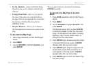
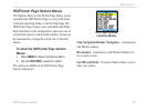
Airport Information Page