


96/96C Owner’s Manual 23
BaSIc operatIon >
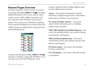
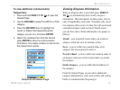
Nearest Pages Overview
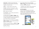
In Aviation Mode, the Nearest function is accessed
by pressing and holding DIRECT TO
D
, providing
detailed information on the nearest airports, airport
weather sources, VORs, NDBs, intersections, and
user waypoints within 200 miles of your present
position. You can also access information regarding
the ve nearest FSS (flight service station) and center
(ARTCC) points of communication, along with their
associated frequency(s).
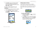
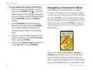
In Marine and Automotive Modes, DIRECT TO
D
operates as a Find key, opening the Find Menu so you
can easily search the stored Waypoints, Cities,
Aviation, and Recent Find. Loading MapSouce data
provides additional search options.
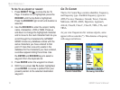
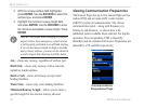
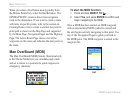
Airport—nine nearest with identier, bearing to
and distance, length of longest runway, and common
trafc advisory (CTAF) or tower frequency.
Wx (Airport Weather Sources)—nine nearest
airport weather information sources, including
AWOS, ASOS, and ATIS.
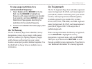
VOR (VHF Omnidirectional Radio Beacons)—nine
nearest with identier, facility type (symbol), bearing
to and distance, and frequency.
NDB (Non Directional Beacons)—nine nearest
with identier, facility type (symbol), bearing to and
distance, and frequency.
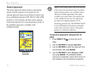
INT (Intersection)—nine nearest with identier,
bearing to and distance.
User (Waypoints)—nine nearest with name, bearing
to and distance.