


96/96C Owner’s Manual 17
BaSIc operatIon >
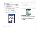
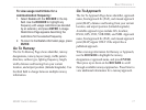
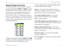
To view usage restrictions for a
communication frequency:
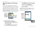
1. Select Comm with the ROCKER in the top
eld. Use the ROCKER to highlight any
frequency with usage restrictions (as denoted
by an asterisk), and press ENTER. A Usage
Restrictions Page appears describing the
restrictions for the selected frequency.
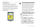
2. To return to the Comm information page, press
ENTER.
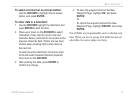
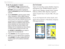
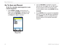
Go To Runway
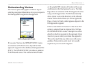
The Go To Runway Page shows identier, runway
designations, runway layout (map), trafc pattern
direction, surface type, lighting frequency, length,
width, distance and bearing from your current
location, and airport position (latitude/longitude). Use
the third eld to change between multiple runway
information.
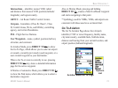
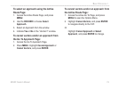
Go To Approach
The Go To Approach Page shows identier, approach
name, nal approach x (FAF), and missed approach
point (MAP), distance and bearing from your current
location, and airport position (latitude/longitude).
Available approach types include ILS, localizer,
RNAV, GPS, VOR, VOR/DME, and NDB. Approach
name, nal approach x (FAF), and missed approach
point (MAP) appear ONLY if the airport has a
published approach.
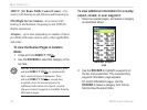
When viewing information for Runway or Approach,
use the ROCKER to highlight the runway
designation or approach name, and press ENTER.
Then press up or down on the ROCKER to scroll
through available runways/approaches. Press Enter to
view additional information for a runway/approach.