


96/96C Owner’s Manual 15
BaSIc operatIon >
Intersections—identier, nearest VOR, radial
and distance from nearest VOR, position (latitude/
longitude), and region/country.
ARTCC—Air Route Trafc Control Centers.
Airspace—boundaries (Class B, Class C, Class
D, Control Zones, SUAs, and MOAs), controlling
agency, and vertical boundaries.
FSS—Flight Service Stations.
User Waypoints—name, symbol, position (lat/lon),
elevation, and comment.
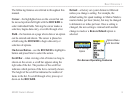
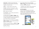
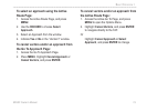
In Aviation Mode, press DIRECT TO
D
to show
the Go To Page, which allows you to select an airport
or navaid, a recently (previously) used waypoint, or a
user-created waypoint as your destination.
When a Go To or route is currently in use, pressing
DIRECT TO
D
key shows a detailed information
page for the active waypoint.
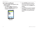
In Marine or Automotive Mode, press DIRECT TO
D
to show the Find menu, which allows you to select a
destination waypoint.
Also, in Marine Mode, pressing and holding
DIRECT TO
D
creates a Man OverBoard waypoint
and starts navigating to that point.
* Symbology used for NDBs, VORs, and airports are
consistent with those used on a sectional chart.
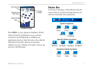
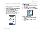
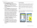
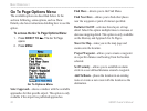
Go To Aviation
The Go To Aviation Page shows the (Airport)
identier, CTAF or tower frequency, facility name,
city/state/country, available fuels, eld elevation,
distance and bearing from your current location, and
airport position (latitude/longitude).
Aviation Mode Go To Page
Options
List