


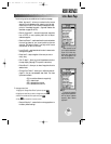
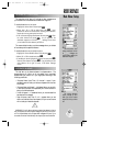


REFERENCE
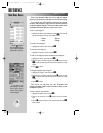
The GPSMAP 195 pro-
vides 11 different position
formats to display your
location. All grid formats,
except UTM/UPS and
Maidenhead, cover only a
specific region.
Over 100 different
datum references are pro-
vided to allow the GPS posi-
tion to correspond to vari-
ous paper charts. Use WGS
84 unless your chart speci-
fies otherwise.
71
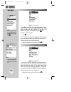
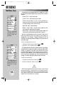
POSITION FORMAT/DATUM (cont.)
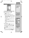
The default position format is latitude and longitude in degrees and
minutes (hdddºmm.mmm’). The following additional formats are
available:
• hddd.dddddº— latitude and longitude in decimal degrees only
• hdddºmm’ss.s”— latitude and longitude in degrees, minutes
and seconds
• British Grid— British National Grid
• German Grid— German National Grid
• Irish Grid— Irish Transverse Mercator Grid
• Maidenhead— Maidenhead Locator System
• Swedish Grid— Swedish Grid
• Swiss Grid— Swiss Grid
• Taiwan Grid— Taiwan Grid
• UTM/UPS— Universal Transverse Mercator and Universal Polar
Stereographic grids
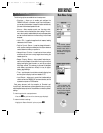
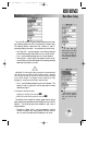
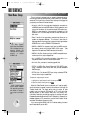
To change the position format:
1. Highlight the ‘Position Format’ field and press
T
.
2. Select the desired position format and press
T
.
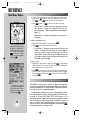
The map datum field is located below the position format field.
The default setting is WGS 84. Although over 100 datums are
available (as listed in Appendix G) for use, you should only change
the datum if you are using a map or chart that specifies a different
datum than WGS 84. If the map/chart does not specify a reference
datum, you may select each datum applicable to your region until
you find the datum that provides the best positioning at a known
point.
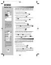
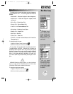
WARNING: Selecting the wrong map datum, or a datum that does not
apply to your region, can result in substantial position error. When in doubt,
use the default WGS 84 datum for best overall performance.
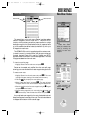
To change the map datum reference:
1. Highlight the ‘Map Datum’ field and press
T
.
2. Select the desired map datum and press
T
.
!
Main Menu: Setup
gps 195 manual C 7/1/99 4:49 PM Page 71