


REFERENCE
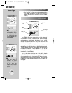
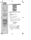
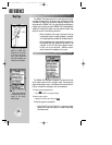
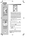
Zoom in to see more
detail for a smaller area.
Notice the ‘ovr zm’ warning
in the lower right corner.
Extra caution should be
used when exceeding the
resolution of the map data.
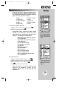
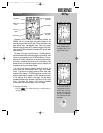
Select ‘Restore Defaults?’
to instantly reset the map
options to the factory
default settings.
54
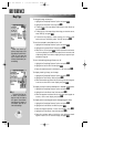
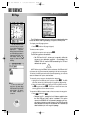
SELECTING MAP SCALES (cont.)
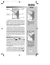
The GPSMAP 195’s system has a built-in base map providing best
map detail at scales down to 20 nautical miles. Worldwide coverage
is available by adding the International Mapping Datacard to an
Americas-version GPSMAP 195, or by adding the Americas Mapping
Datacard to an International-version GPSMAP 195. Datacards are also
available for Canada and Alaska to provide additional detail. Map
detail will conform to the following conditions:
• When the selected zoom range is covered by both the
internal base map and a mapping datacard, map detail
will be displayed using the data with the best resolution.
• When the selected zoom range exceeds the resolution of
the available chart data, overzoom map detail will be
displayed. An ‘Ovr Zm’ warning will appear on the sta-
tus bar, next to the map scale. Additional caution
should be used while navigating in this mode.
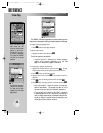
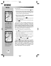
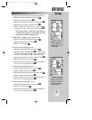
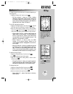
The GPSMAP 195 map page is designed to be a flexible tool that
can be custom-tailored to your navigation needs. The map options
page provides access to many of the features and functions that will
help you configure the map page to your own preferences.
To display the map page options:
1. Press
O
(with the map page displayed).
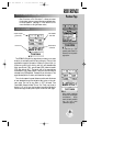
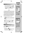
To select a menu option:
1. Highlight the desired option and press
T
.
The following options are available:
• Data Fields Off or Data Fields On?— allows you to select
between a full-screen map display or the default map display
with data window.
MAP PAGE OPTIONS
Map Page
gps 195 manual C 7/1/99 4:49 PM Page 54