


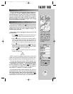
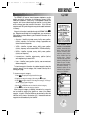

REFERENCE
The GPSMAP 195 is
available in three database
versions: Americas covers
North, Central and South
America. Atlantic Inter-
national covers Europe,
Africa, Middle East and
northern Asia. Pacific
International covers Asia,
Australia, Middle East and
Eastern Europe. The data-
base cycle is displayed with
the aviator’s warning. A
database update can be
ordered from your dealer or
directly from GARMIN.
27
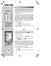
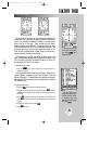
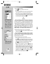
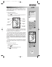
WAYPOINT CATEGORIES
The GPSMAP 195 uses an internal Jeppesen database to provide
position and facility information for thousands of airports, VORs,
NDBs and intersections. Each facility in the database is stored as a
waypoint, with its own latitude/longitude, identifier (up to six letters
and/or numbers) and other pertinent information. Up to 250 user
waypoints and 250 symbol waypoints may also be created and stored
in memory.
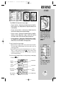
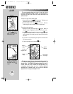
Waypoint information is available through the GPSMAP 195’s
W
key. Waypoints are divided into five categories for your convenience.
Each category provides different types of detailed information for a
selected facility:
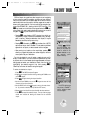
• Airports— Identifier, city/state, country, facility name, position
(lat/lon), elevation, fuel services, runways, approaches and
communications frequencies.
• VORs— Identifier, city/state, country, facility name, position
(lat/lon), frequency and co-located DME or TACAN availability.
• NDBs— Identifier, city/state, country, facility name, position
(lat/lon) and frequency.
• Intersections— Identifier, region/country, position (lat/lon)
and range/bearing to nearest VOR.
• User— Identifier (name), position (lat/lon), user comments and
reference waypoint.
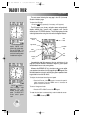
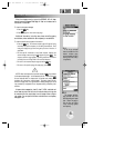
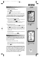
To view the waypoint information for a desired waypoint, select the
waypoint category from the category field, located at the top left of
the waypoint page.
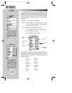
To choose a waypoint category:
1. Press
W
to display the waypoint definition page.
2. Highlight the waypoint category field using the
R
keypad.
3. Press
T
to begin selection of the waypoint category. A listing of
all five category types will appear.
4. Use the UP or DOWN arrows to select the desired category.
5. Press
T
to confirm the category selection.
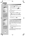
After a waypoint category is selected, information for a waypoint
can be viewed by entering the identifier or name of the desired
waypoint. Airports, VORs, and NDBs may be retreived by either the
identifier, facility name, or the location (city). Intersections and user
waypoints must be selected by the identifier.
WW
KEY
Waypoint Categories
gps 195 manual C 7/1/99 4:48 PM Page 27