


cGPSmapper Manual Map Project
http://cgpsmapper.com/ 31 of 100
This is equivalent of:
Numbers1=0,E,1,9,O,4,20
Numbering style can be: N,E,O,B – which suits to: None, Even, Odd, Both.
4.3 Marine Charts
Marine charts are a special kind of cartography - similar to Garmin's BlueChart - that is
used as navigational aid and contains its own set of marine elements.
Although marine charts are generated, managed and compiled in the same way as ordinary
maps, certain restrictions apply to the attributes of the objects (e.g. extended attributes like
CityName, RegionName, StreetDesc are not applicable - marine objects are not searchable).
Such restrictions are explained in the present section.
All the attributes listed herewith are meant to be included in one of the following sections:
[POI], [POLYLINE], [POLYGON].
Refer to section 4.2 (on page 8) for details on these sections.
Marine maps cannot be transparent.
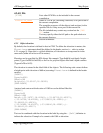
Marine=x
Indicates if the object is of marine type.
N or 0 non-marine object
Y or 1 marine object
Default = Marine value from the [IMG ID] section. If
not present, default = N.
Marine objects use many additional special attributes, which are listed below.
Marine objects have only the following keys in common:
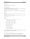
Type=object_type
Type of element, may be written in hex or decimal or as a
name (valid names are defined in file RGNtyps.txt which
you can customised to your requirements).
SubType=object_typ
e
SubType defines the second byte of the Type value.
The type of element can be defined either by using the Type
key only or by using the Type and SubType keys.
Example:
Type=0x0211
can be also written as:
Type=0x02
SubType=0x11