cGPSmapper Manual Map Project
http://cgpsmapper.com/ 14 of 100
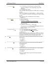
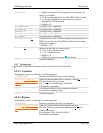
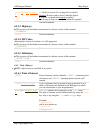
Preview=x
Refer to section 6.2 (Creating preview map files), on
page 61, for details.
N map designated for use with GPS will be created
Y map designated for use as preview map for
MapSource will be created
Default = N
AlignMethod
No longer used / supported.
BlockSize
No longer used / supported.
LevelFill
No longer used / supported.
LevelLimit
No longer used / supported.
WorldMap
No longer used / supported.
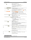
DrawPriority=#
Value between 1 and 255 indicating the priority used by the
GPSr to draw the map. The GPSr will show first the maps
with lower numbers.
Default = 25.
Marine=x
Indicates if the map is of marine type.
N or 0 non-marine map
Y or 1 marine map
Default = N.
Refer to section 0 (on page 30) for details.
[END]
Section terminator.
4.2.2 Declarations
The DECLARATION elements must be in the order shown herewith.
4.2.2.1 Countries
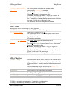
Although this section is obsolete, it is still supported.
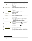
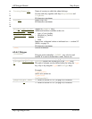
[COUNTRIES]
Declares all countries used for city indexing
Country#=country_n
ame~[0x1d]abbrevia
tion
Name and abbreviation used to identify country #.
The first # must always be one.
E.g.: Country1=United States~[0x1d]US
80 characters maximum.
...
The statement above can be repeated as needed.
# must be in ascending order.
[END]
Section terminator
4.2.2.2 Regions
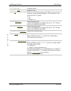
Although this section is obsolete, it is still supported.
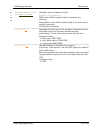
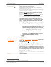
[REGIONS]
Declares all regions used for city indexing
Region#=region_nam
e~[0x1d]abbreviati
on
Name and abbreviation used to identify region #.
The first # must always be one. Subsequent # must be
ordered ascending.
E.g.: Region1=New York~[0x1d]NY
80 characters maximum.


