cGPSmapper Manual Map Project
http://cgpsmapper.com/ 22 of 100
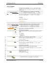
4.2.4.3 Polyline
[POLYLINE]
Polyline section identifier. [RGN40]may also be used
instead. It is used to define linear objects such as streets,
streams, etc.
Type=object_type
Refer to section 4.2.4.1 (on page 18) for details.
SubType=object_typ
e
SubType defines the second byte of the Type value.
The type of element can be defined either by using the Type
key only or by using the Type and SubType keys.
Example:
Type=0x0211
can be also written as:
Type=0x02
SubType=0x11
Label=object_name
Refer to section 4.2.4.1 (on page 18) for details.
Label2=object_name
Secondary name of the object –only applies to roads.
EndLevel=#
Refer to section 4.2.4.1 (on page 18) for details.
Data#=(lat1,lon1),
(lat2,lon2)...
Refer to section 4.2.4.2 (on page 20) for details.
StreetDesc=xxx
Street alias or secondary street name.
80 characters maximum.
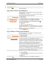
DirIndicator=x
Show direction of the road when selecting intersection in
GPS
0 No
1 Yes
Default = 0
σ
τ
π
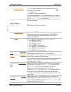
CityName=xxx
Name of city to which this object belongs.
Can be used only together with keys RegionName and
CountryName.
80 characters maximum.
σ
τ
π
RegionName=xxx
Name of region to which this object belongs.
Can be used only together with keys CityName and
CountryName.
80 characters maximum.
σ
τ
π
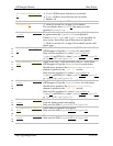
CountryName=xxx
Name of country to which this object belongs.
Can be used only together with keys RegionName and
CityName.
80 characters maximum.
σ
τ
π
Zip=xxx
Object Zip Code.
80 characters maximum.
RoadID=xxx
π
Numbers#=xxx
Refer to section 4.2.6 (on page 30) for details.


