


Magellan NAV 6000 47
Selecting Map Datum
The NAV 6000 allows you to select from 73 map datums.
All information displayed on the map screen is
based on WGS84. Only position coordinates
displayed on the NAV1 screen and waypoint
coordinates entered manually (not through the
map) are based on the map datum selected by the
user through the SETUP MENU.
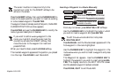
Press the MENU softkey, from any of the navi-
gation screens, highlight System Setup and press
ENTER.
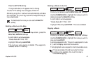
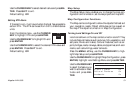
The SETUP MENU appears. Use the CUR-
SOR KEY to highlight MAP DATUM, press
ENTER and a window opens showing the MAP
DATUM options.
Use the CURSOR KEY to highlight the de-
sired map datum and press ENTER to set.
Press QUIT to exit.
Default setting: WGS84
Selecting Elevation Mode
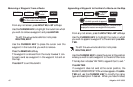
Press the MENU softkey, from any of the navigation screens,
highlight System Setup and press ENTER. The SETUP
MENU appears.
Use the CURSOR KEY to highlight Elev
Mode, press ENTER and a window opens
showing elevation mode options.
Use the CURSOR KEY to highlight 2D or 3D (Auto) and
press ENTER. In 2D, the altitude is set at the value entered
under INIT. In 3D (Auto), the unit calculates the horizontal
position as well as altitude if 4 or more satellites are tracked,
and horizontal position only if 3 satellites are tracked.
Press QUIT to exit.
Default setting: 2D
Selecting Elevation, Distance, Speed and Depth Units
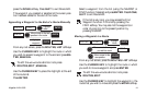
Press the MENU softkey, from any of the navigation screens,
highlight System Setup and press ENTER.
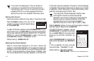
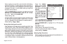
The SETUP MENU appears. Use the CUR-
SOR KEY to highlight Units, press ENTER
and a window opens showing the UNITS
menu: Elev, Dist, Speed and Depth.
Elevation Units
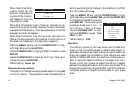
From the UNITS menu, use the CURSOR KEY to high-
light Elev and press ENTER.
Use the CURSOR KEY to highlight Feet
or Meters and press ENTER.
Default Setting: Feet
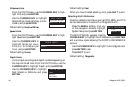
ELEV UNITS
Feet
Meters
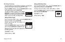
UNITS
Elev - FT
Dist - NM
Speed - KT
Depth - FT
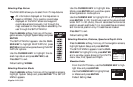
2D
3D (Auto)
ELEV MODE