


Magellan NAV 600020
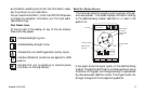
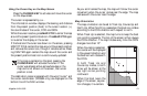
Press the
HIDE
softkey to temporarily remove the infor-
mation window, extending the map to the full screen size.
Press any softkey to redisplay the information window.
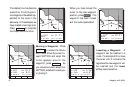
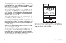
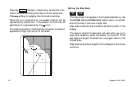
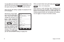
When the unit computes a fix, the present position will be
represented by a boat icon. If the position is more than 20
seconds old it is represented by the (
) icon.
If the last computed fix is differentially corrected, the letter D
appears at the top right corner of the screen.
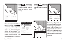
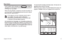
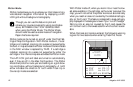
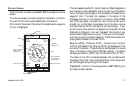
Setting the Map Scale
ZOOM
IN
ZOOM
OUT
The map screen first appears in the highest scale setting. Use
the ZOOM IN and ZOOM OUT keys to zero in on a small
area of the map or pan over a larger area.
Map scale is defined as the distance across the width of the
display.
The receiver retains the scale level last used when you go to
view other screens or when the receiver is turned off. If the
cartridge is changed, the screen will once again zoom to the
highest scale.
Map scale can also be changed from the Waypoint and Route
functions.
Los Angel
WPT002
WPT001