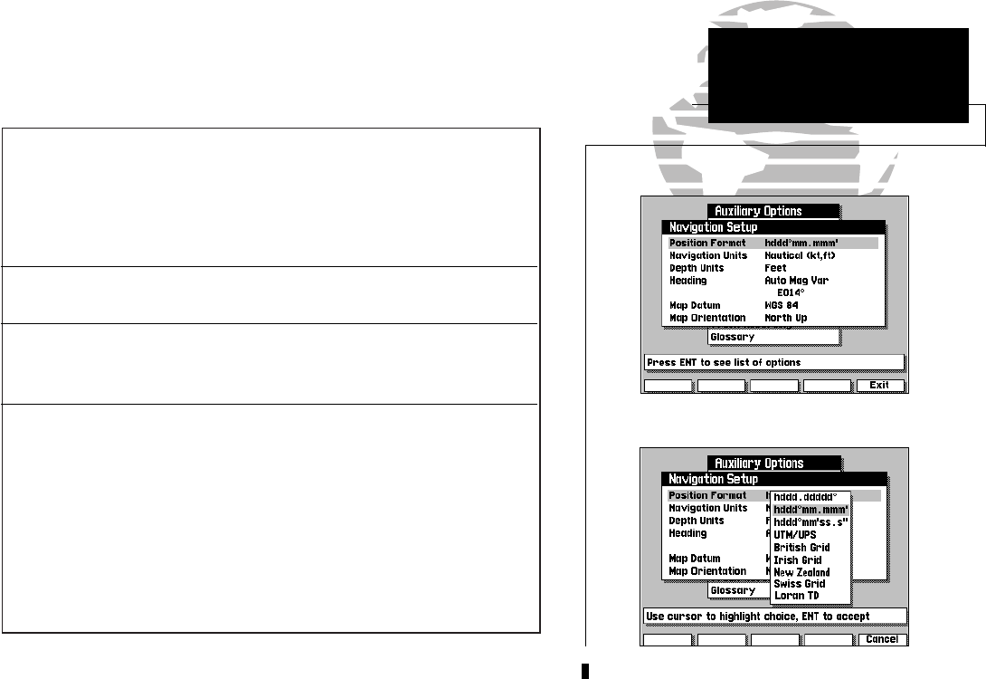
Position Format lets you select the coordinate system used to display
position. You can select latitude/longitude in three display formats: degrees only
(e.g., N37.25818º), degrees and minutes (e.g., N37º15.490) or degrees, minutes
and seconds (e.g., N37º15’29.4”). Options are also available for UTM/UPS coordi-
nates, British, Irish, New Zealand or Swiss grids and Loran TDs. For more
information on the Loran TD position format, see Appendix H.
Navigation Units selects the format for speed and distance measurements. You
may select from nautical, statute or metric formats.
Depth Units selects the format for depth contour display on G-chart™
electronic chart cartridges. Depth contours can be displayed in feet, meters or
fathoms. The default setting is meters.
Heading lets you select what reference is used in calculating heading information.
You can select to reference automatic magnetic variation, true north, grid heading
or user magnetic variation. To enter a user magnetic variation:
To enter a user magnetic variation:
1. Select the ‘User Mag Var’ option and press the C key.
2. Use the K keypad to highlight the variation field and press C.
3. Enter the desired variation and press the OK softkey. Pressing the C key
after entering the final character value will also confirm the entry.
49
The navigation setup submenu is used to select a variety of navigation infor-
mation, including position format, units of measure, and heading preferences.
This submenu is also used to select map datums and map display orientation.
SECTION
9
AUXILIARY MENU
Navigation Setup &
Units of Measure
215225manb.qxd 4/27/00 9:22 AM Page 49


