23
The GARMIN GPSMAP system features a graphic map display with 16 zoom
scales from 1/8th to 4096 n.m. (1/4 to 7500km). By using G-chart
TM
inland
and offshore chart cartridges, the map display can show a wide variety of chart
details such as depth contours, shorelines, marinas and navigation aids.
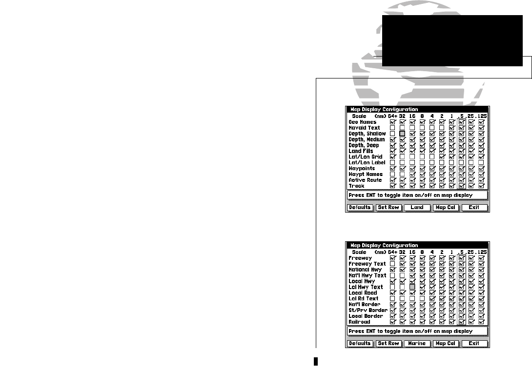
The MAP CFG softkey allows you to determine what chart features are dis-
played on a particular range scale. By selecting individual features on the map
configuration windows, you can choose what specific information to display.
To access the map display configuration windows:
1. Press the MAP CFG softkey.
The configuration windows feature an on/off grid with a list of chart features
down the left side of the grid. The zoom scales are displayed across the top of
the grid, with the chart scale currently in use indicated by a box outline
around the selection grid The far left column denotes range scales 64 n.m.
(120 km) and greater. A check mark in a grid box indicates that the chart fea-
ture listed will be displayed at the scale marked at the top of the grid. A con-
figuration grid is available for Marine and Land data.
To select a configuration window for Marine or Land data:
1. Press the MARINE or LAND softkey (as appropriate).
Individual grid boxes are turned on and off with the C key, while entire
rows may be controlled by using the configuration softkeys.
To use the map configuration grid:
1. Use the K key to toggle an individual grid box on or off.
2. Press the DEFAULTS softkey to return the entire grid to the factory settings.
3. Use the SET ROW softkey to turn an entire horizontal row on.
4. Use the CLR ROW softkey to turn an entire horizontal row off.
SECTION
2
MAP CONFIGURATION
Selecting On-Screen
Display Features
Marine Data Configuration
Land Data Configuration
215225manb.qxd 4/27/00 9:22 AM Page 23


