


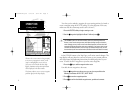
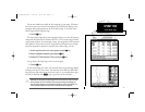
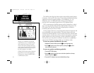

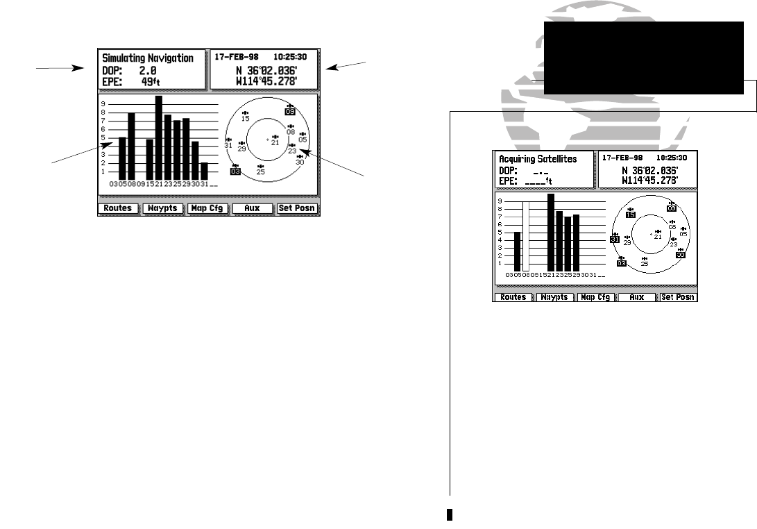
In this example, satellites 5, 21, 23, 25 and 29 are
currently being tracked, with the corresponding
signal strength bars indicating the relative strength
of the signals. Satellites 3, 9, 15, 30 and 31 (shown
with numbers highlighted) are visible, but are not
currently being tracked. Satellite 8 is being received
(as indicated by a hollow bar), but the data is not
yet available for use in determining your position.
NOTE: For first time operation, GPSMAP 215 and
225 units may require 5 minutes to collect initial
satellite almanac data and establish a present
position. You may speed up the initial acquisition
process by entering an initial position (see page 16).
15
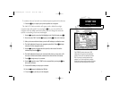
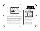
The GPSMAP 215/225 Satellite Status Page provides a visual reference of
various receiver functions, including current satellite coverage, receiver
operating mode and present position or DGPS status. The status information
will give you an idea of what the receiver is doing at any given moment.
The sky view and signal strength bars give you an indication of what
satellites are visible to the receiver and whether or not they are being tracked.
The signal strength is shown on a bar graph for each satellite, with the satellite
number below. When a satellite is visible but not being tracked, the strength
bar will remain blank and the sky view indicator will remain highlighted.
The sky view shows a bird’s eye view of the position of each satellite relative
to the receiver’s last known position. The outer circle represents the horizon
(North up); the inner circle 45º above the horizon; and the center point a
position directly overhead. Use the sky view to determine if there are
obstructions shading your reception of GPS signals.
SECTION
1
Position
Field
(or Beacon
Status)
Satellite
Sky
View
Status
Field
Signal
Strength
Indicators
SATELLITE
STATUS PAGE
Overview
215225manb.qxd 4/27/00 9:22 AM Page 15