


25
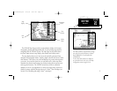
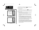
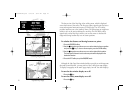
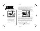
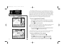
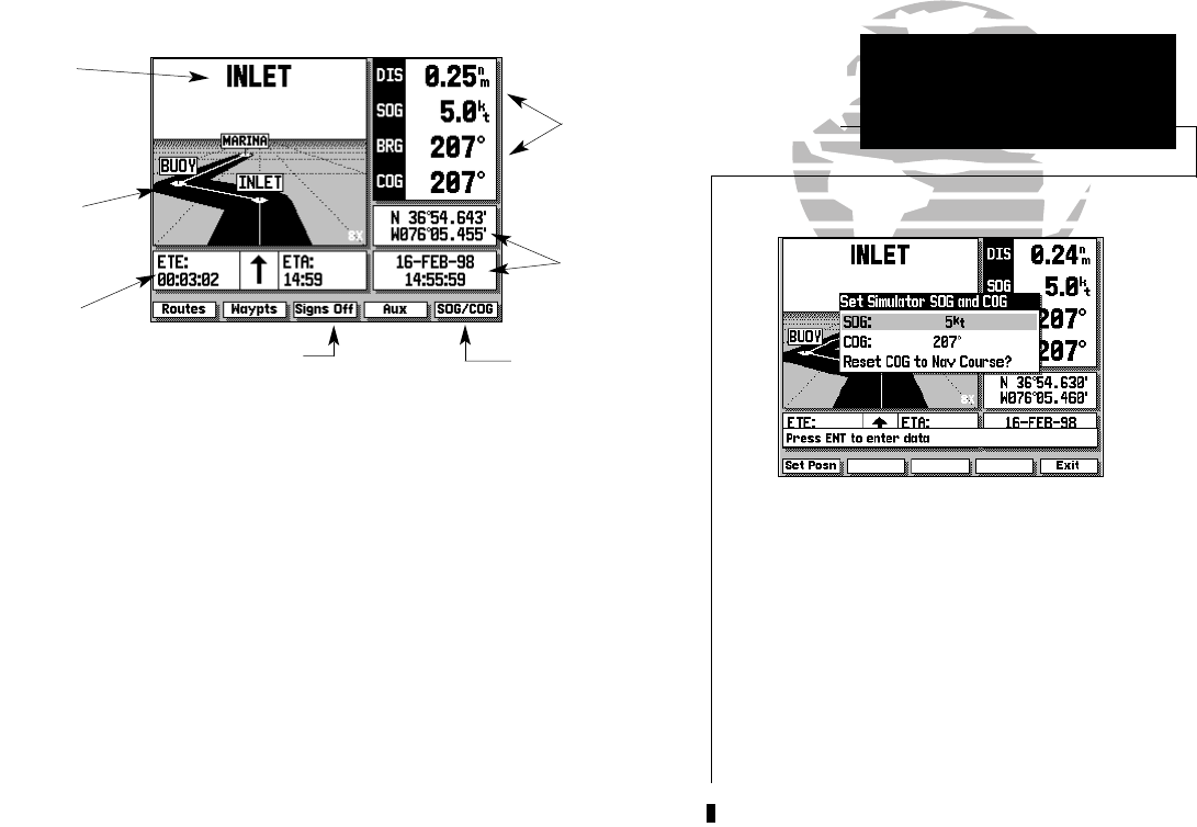
The GPSMAP Highway Page provides a large character display of navigation
data and graphic steering guidance to an active waypoint via a highway
display. The active destination waypoint is displayed at the top of the screen,
with the ETE (estimated time enroute) and ETA (estimated time of arrival)
based on your present speed and course at the bottom.
The distance and bearing to the destination waypoint, along with your pre-
sent speed and course over ground (SOG and COG) are shown along the right
hand side. The SOG and COG fields may also be changed to display your
velocity made good and turn value (VMG and TRN).
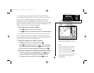
To display VMG and TRN:
1. Press the B key. To return the display to SOG and COG, press B again.
The last two fields on the Highway Page are the position and date/time
fields. The position field displays your present GPS position or a simulator
mode position you have entered manually. The date/time field displays the
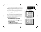
The SIGNS OFF softkey allows you to remove the
waypoint name markers which appear on the
graphic highway display.
Whenever your GPSMAP is in simulator mode, a
SOG/COG softkey will appear in the softkey
menu. Use the SOG/COG softkey to set the speed
and course for your simulated trip (see pg. 9-10).
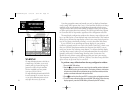
Once you are in the SOG/COG window, you can
also set a simulator position graphically by press-
ing the SET POSN softkey and following the steps
outlined on page 16.
SECTION
3
Distance,
Bearing, Speed
& Course
Fields
Position &
Time/Date
Fields
Active
Destination
Highway
Display
ETE & ETA
Fields
Simulator Speed &
Course Softkey
HIGHWAY PAGE
Overview
Remove Waypoint Name
Markers Softkey
215225manb.qxd 4/27/00 9:22 AM Page 25