


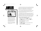

20
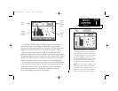
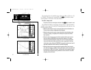
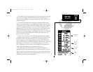
The map display has 16 available range scales from 1/8th to 4096 n.m. (1/4
to 7500km). The map scale is controlled by the
L key, with the current
scale displayed at the bottom of the data window.
To select a map scale:
1. Press the arrow icon on the right or left side of the L key to zoom in or out.
The GPSMAP will display cartography as long as there is chart information
available for the range you’ve selected. Zooming operation will conform to the
following default settings:
• When the selected zoom range is covered by either the internal database or a
G-chart
TM
data cartridge, cartography will be displayed.
• When the selected zoom range is covered by both the internal database and
a G-chart
TM
cartridge, cartography will be displayed using the data with the
best resolution.
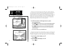
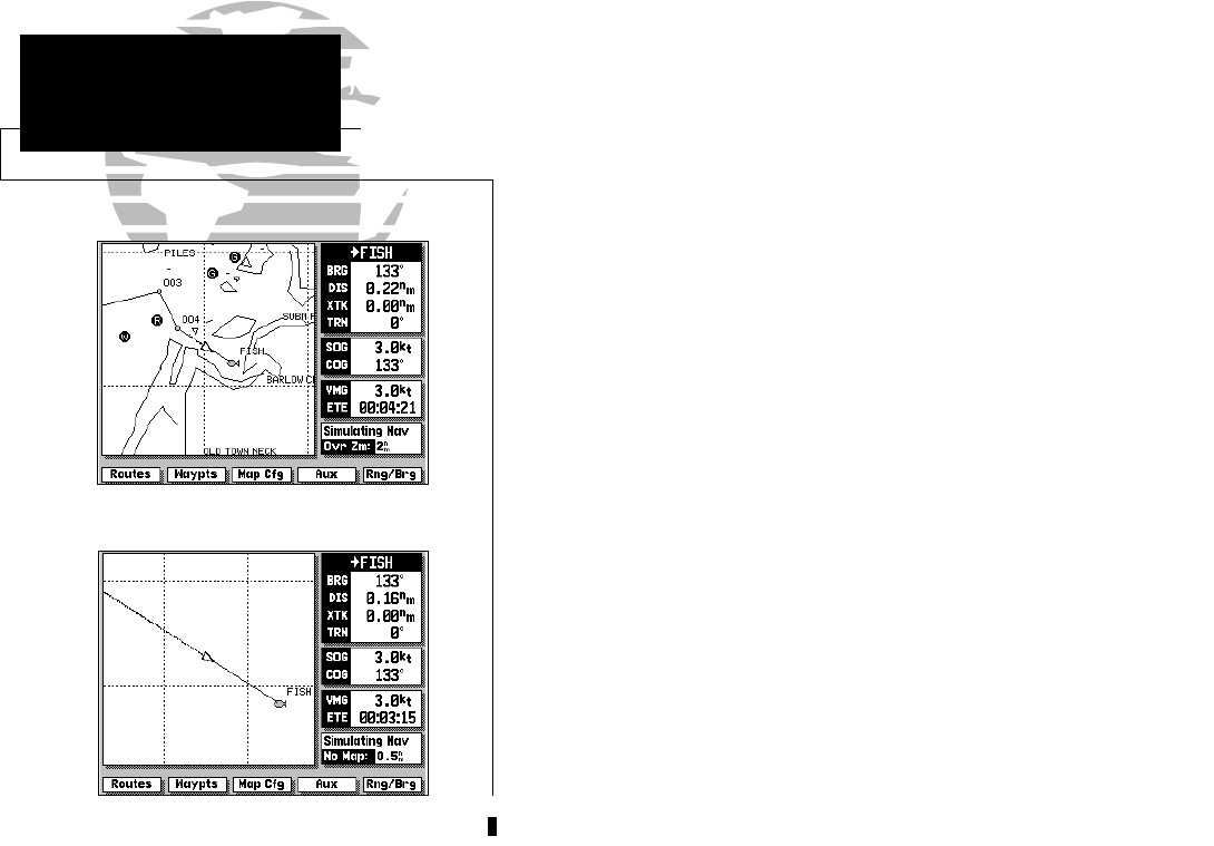
• When the selected zoom range exceeds the resolution of the chart in use by
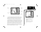
up to two settings, OVERZOOM cartography will be displayed. The display
will not show any filled landmass areas, and an ‘Ovr Zm’ warning will appear
in the scale field and the lat/lon grid will be turned on regardless of the map
configuration setting. Although OVERZOOM cartography provides some level of
map detail, additional caution should be used while navigating.
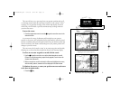
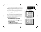
• When the selected zoom range exceeds the resolution of the chart in use by
more than two settings, a ‘No Map’ warning will appear and all cartography will
be replaced by a TRACK PLOT display. The lat/lon grid will be displayed regard-
less of the map configuration setting. Additional caution should be used while
navigating in track plot mode.
SECTION
2
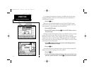
Overzoom Mode
Track Plot Mode
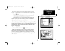
MAP PAGE
Selecting Zoom Scales
215225manb.qxd 4/27/00 9:22 AM Page 20