As you move the cursor, the distance and
bearing from your present position to the
cursor will be displayed in the destination
field (at the top right of the screen).
The cursor’s position coordinates will be dis-
played in the position field (below the speed
and course field).
While in cursor mode, the boat icon will
continue to move, and may go off screen to
accommodate the scrolling cursor.
6
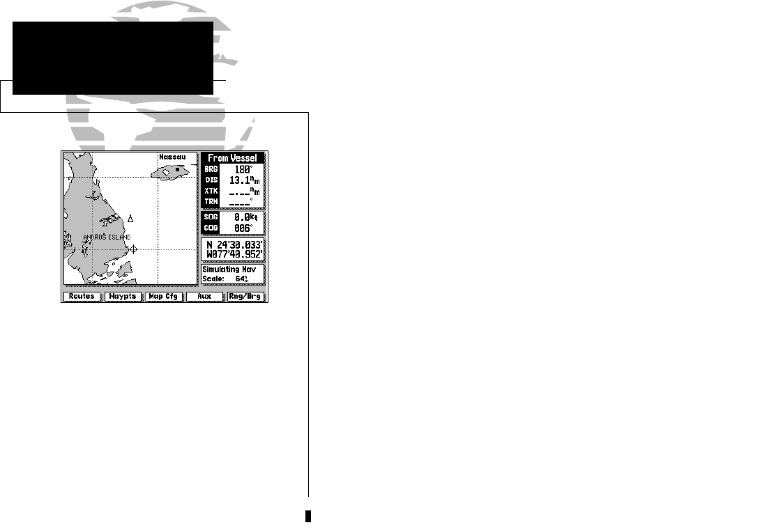
Using the Map Page is a simple process that centers around the use of the
cursor. Controlled by the arrow keypad, the cursor is an important tool that
can be used as a distance and bearing marker, to create new waypoints and
routes, and to review position data of on-screen waypoints, buoys and
markers. Try moving the cursor using the following exercise:
1. Use the L key to set the map scale to 64 n.m.
2. Your boat should be in the center of the map display, near Andros Island and
Nassau (the position you entered earlier).
3. Press the bottom arrow of the K keypad to move the cursor down to the first
lat/lon grid South of your boat’s position.
4. Using the K keypad to move the target crosshair in each direction, try follow-
ing the outline of the lat/lon grid closest to your boat. Notice how the
destination field of the data window displays the distance and bearing from
your position to the target cursor, with the cursor’s coordinate position
indicated in the position field.
5. Press the A key to eliminate the cursor and re-center your position on the
map display.
As you become more familiar with using the cursor, you’ll see that the map
display actively scrolls forward with your panning, letting you explore areas
around the world (even outside of your current G-chart
TM
coverage) and create
waypoints and routes. Wherever you move the cursor, you’ll always be one
A keystroke away from returning to your present position.
GPSMAP TOUR
Using the Target Cursor
215225manb.qxd 4/27/00 9:22 AM Page 6


