


ii GPSMAP 620 and GPSMAP 640 Owner’s Manual
Table of Contents
Table of Contents
Introduction ...........................................................................i
Product Registration ..................................................................... i
Contact Garmin
® ..................................................................................................................................
i
Manual Conventions ..................................................................... i
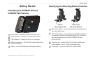
Getting Started .....................................................................1
Identifying the GPSMAP 620 and GPSMAP 640 Features .......... 1
Identifying the Mounting Bracket Features .................................. 1
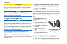
Using the Mounting Bracket ......................................................... 2
Powering the Device On and Off ................................................. 3
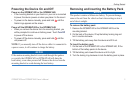
Removing and Inserting the Battery Pack .................................... 3
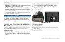
Inserting and Removing a Secure Digital (SD) Card ................... 4
Marine Mode: Getting Started ............................................5
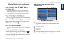
Step 1: Mount Your GPSMAP 620 or GPSMAP 640.................... 5
Step 2: Congure Your Device ..................................................... 5
Step 3: Acquire Satellites ............................................................. 5
Step 4: Use Your GPSMAP 620 or GPSMAP 640 ....................... 5
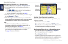
Navigating Directly to a Destination ............................................. 6
Saving Your Current Location ...................................................... 6
Navigating Directly to a Saved Location ...................................... 6
Stopping Navigation ..................................................................... 7
Adjusting the Volume ................................................................... 7
Adjusting the Backlight ................................................................. 7
Marine Mode: Using Charts ................................................8
Using the Navigation Chart .......................................................... 8
Interacting with Objects on the Navigation Chart ......................... 9
Accessing Additional Object or Chart Information ........................ 9
Using Perspective 3D ................................................................ 10
Using BlueChart g2 Vision ......................................................... 10
Using Mariner’s Eye 3D ..............................................................11
Using Fish Eye 3D ......................................................................11
Using Fishing Charts ...................................................................11
Enabling High-Resolution Satellite Imagery ............................... 12
Marine Mode: Navigating ..................................................13
Step 1: Choose a Destination .................................................... 13
Step 2: Set and Follow the Course ............................................ 13
Marine Mode: Where To? ..................................................19
Searching for Marine Services ................................................... 19
Searching for Waypoints ............................................................ 19
Searching for Saved Routes ...................................................... 19
Searching for Saved Tracks ....................................................... 20
Searching by Name ................................................................... 20
Marine Mode: Using Waypoints and Tracks ...................21
Using Man Overboard (MOB) Waypoints................................... 21
Marking a Waypoint at Your Current Location............................ 21
Creating a Waypoint from the Navigation Chart......................... 22
Editing Waypoint Details ............................................................ 22
Using Tracks .............................................................................. 22
Marine Mode: Using the Dashboard ................................24
Using the Compass Screen ....................................................... 24