


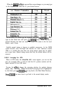
Geodetic Datums
Mariners may find considerable errors (up to 200 meters) in plotting own
ship’s position if their charts were created using one type of geodetic data
system while the GPS calculates positions using another data system.
TheNAV 398 can program the
RAYSTAR
108 to provide position calculations
utilizing several geodetic data systems. For maximum plotting accuracy, you
should set the GPS to match the datum used for your marine chart. The
datums available in the
Raystar
108 are listed below and in Table A on the
following page:
1.
WGS-84
2. WGS-72
3.
BESSEL (JAPAN)
4. NAD-27 (USA)
5
NAD-27 (CANADA)
6. EURO-50 (Europe)
7.
AUST-66 (Australia)
8.OSGB-36
9.
NAD-83
10. Other datums (see table)
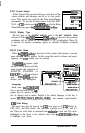
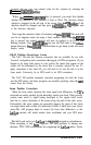
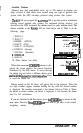
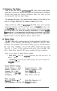
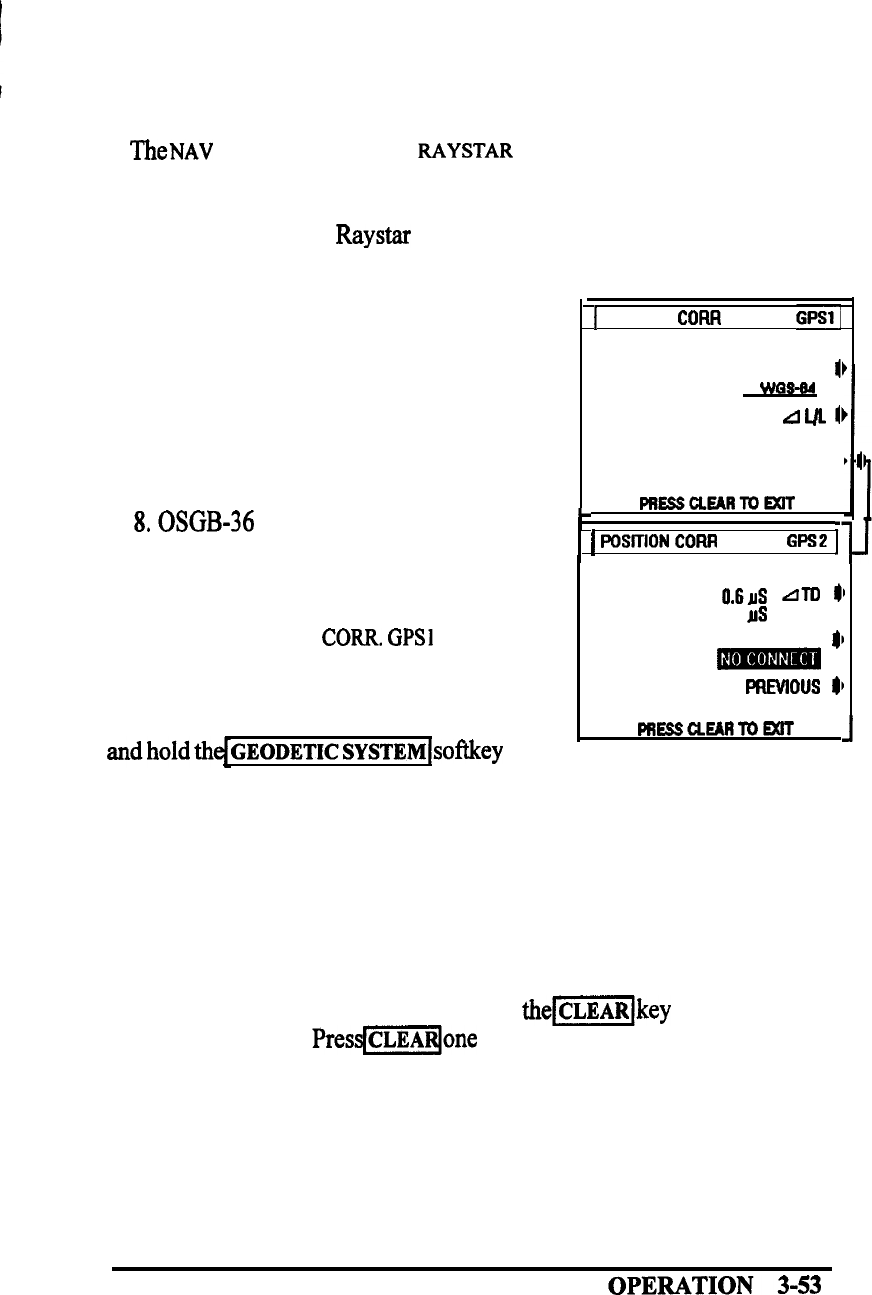
When the POSITION
CORR.
GPSl
menu is dis-
played the screen displays the current Geodetic
datumused by the GPS sensor. To move through
the datum list and select a different datum, press
GEODETICSYSTEM~~~~~~
down
to scroll the datum list.
1
POSITION CORR GPSl1
GEODETIC SYSTEM
11
WQS-W
N 00.00’
LIIJL
II
w 00.00’
NM
(1
PREsscLEhRm6xlT
,
L
1
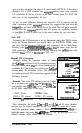
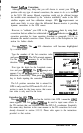
WSITION
COFUI
GPSZ
Iv
0.6~1s
Am
@I
3.1
rs
DGPS BEACON SELECT
$1
-
PREvlous 8,
PREsclEARmmrr
1
Datums named on the list above will appear first in the sequence. When the
two digit numbers appear, continue holding the key until the desired number
is displayed. The numbers correspond to the datums listed on Table A. When
the datum or datum number you desire is displayed, it will become the datum
used for L/L calculations.
If you are finished with this menu, press
them[key
to return to the
MAIN MENU
Directory.
Presqmqone
more time to get back to the normal
navigating screens.