


91
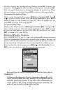
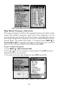
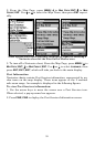
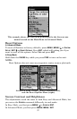
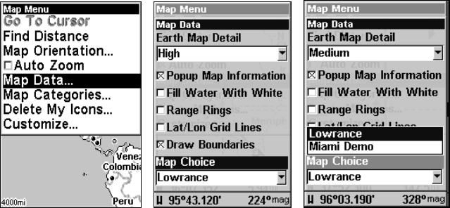
2. From the Map Page, press
MENU|↓ to MAP DATA|ENT|↓ to MAP
CHOICE|ENT. Use ↑ or ↓ to select the Map Name, then press ENT repeat-
edly.
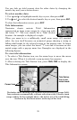
These figures show menu sequence (from left to right) for selecting a
Navionics chart for the West Gulf of Mexico area.
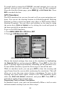
3. To turn off a Navionics chart, From the Map Page, press MENU|↓ to
MAP DATA|ENT|↓ to MAP CHOICE|ENT. Use ↑ or ↓ to select LOWRANCE, then
press
ENT|EXIT|EXIT, which will take you back to the main display.
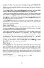
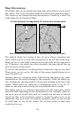
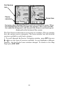
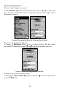
Port Information
Navionics charts contain Port Services information, represented by an-
chor icons on the map display. These icons appear at the 2 nautical
mile zoom range. An example is displayed in the following figures.
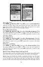
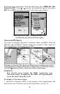
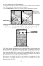
To view Port Services information:
1. Use the arrow keys to move the cursor over a Port Services icon.
When selected, a pop-up name box appears.
2. Press
FIND|FIND to display the Port Services Information screen.