


132
4. As you walk the perimeter of the area you're scouting, record a series
of flag points (using the flag waypoint symbol) that will be used to draw
the scout plot boundary. You need to set enough flag points to roughly
outline the area's corners. For example, while scouting a square soy-
bean field and looking for deer entry points, you could record the field
boundary by setting just four flag points.
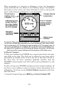
To set the first flag point, press
ENT and the new waypoint menu ap-
pears. Choose a point and press
ENT. The New Waypoint Name box will
appear with Save Waypoint highlighted. Scroll ↑ to Add to Scout and
press
ENT to uncheck it. Now, scroll down to SAVE WAYPOINT and press
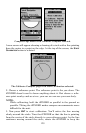
ENT to create your first flag point. After the point is created, the scout
point menu is cleared. Back on the Map Page, the message Scout 1 ap-
pears in the lower right corner, indicating a scouting session is under
way.
5. Repeat these steps for setting a point at every major corner of the
area you're scouting. The iFINDER will link the flag points and draw
the perimeter of the area you walked.
Switch to Land Mode
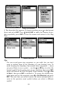
To leave Hunting Mode and switch to Land Mode:
1. Press
MENU|MENU|↓ to DISABLE HUNTING MODE|ENT.
2. The following message appears: Are you sure you want to turn on
Land Navigation Mode?
3. Press
←|ENT and the unit switches to Land Mode.
Switch Back to Hunting Mode from Land Mode
To leave Land Mode and switch back to Hunting Mode:
1. Press
MENU|MENU|↓ to ENABLE HUNTING MODE|ENT.
2. This message appears: Are you sure you want to turn on Hunting
Mode?
3. Press ←|
ENT and the unit switches to Hunting Mode.