


81
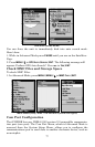
To select a coordinate system:
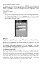
To change the coordinate system, press
ENT|ENT while COORDINATE
SYSTEM is highlighted. Use the ↑ or ↓ arrow keys to highlight the desired
format. Press
ENT to select it. Press EXIT repeatedly to get back to the
main display.
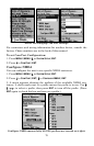
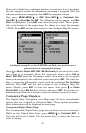
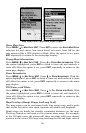
To set up Loran TD:
NOTE:
If the Loran TD conversion is chosen, you must enter the local Lo-
ran chain identification for the master and slaves. Do this by se-
lecting SETUP LORAN TD and pressing ENT|ENT, then choosing the ID.
Press
EXIT to close this menu.
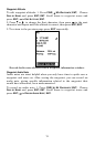
Configure Loran TD menu.
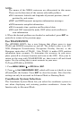
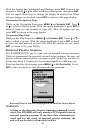
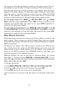
Map Fix
Map Fix is used with charts or maps. This system asks for a reference
position in latitude/longitude, which you take from a marked location
on the map. It then shows the present position as distance on the map
from that reference point.
For example, if it shows a distance of UP 4.00" and LEFT 0.50", you
then measure up four inches and to the left a half-inch from the refer-
ence point on the map to find your location.
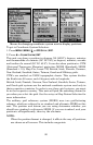
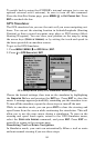
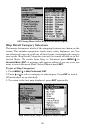
To configure a map fix:
To use this format, you need to follow these steps in order. First, take
your map of the area and determine a reference latitude/longitude.
(Note: in order for this system to work, the latitude/longitude lines must
be parallel with the edge of the map. USGS maps are parallel, others
may not be. Also, this works better with smaller scale maps.) The refer-
ence position can be anywhere on the map, but the closer it is to your
location, the smaller the numbers you'll have to deal with.