


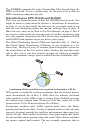

8
least four satellites are in view nearly anywhere on Earth at all times.
The system requires signal reception from three satellites in order to
determine a position. This is called a 2D fix. It takes four satellites to
determine both position and elevation (your height above sea level —
also called altitude). This is called a 3D fix.
Remember, the unit must have a clear view of the satellites in order to
receive their signals. Unlike radio or television signals, GPS works at
very high frequencies. These signals can be easily blocked by trees,
buildings, an automobile roof or your body.
Like most GPS receivers, the iFINDER doesn’t have a compass or any
other navigation aid built inside. It relies solely on the signals from the
satellites to calculate a position. Speed, direction of travel, and distance
are all calculated from position information. Therefore, in order for the
iFINDER to determine direction of travel, you must be moving and the
faster, the better. This is not to say that it won’t work at walking or
trolling speeds — it will. There will be more "wandering" of the data
shown on the display.
GPS alone is plenty accurate for route navigation, but the U.S. Federal
Aviation Administration has special aircraft navigation needs that go
beyond basic GPS. So, the FAA has developed a program to boost GPS
performance with its Wide Area Augmentation System, or WAAS. The
FAA commissioned the system on July 11, 2003. EGNOS (European
Geostationary Navigation Overlay Service) is the European equivalent
of WAAS. Like WAAS, it was created to make GPS position calculation
more accurate.
WAAS is designed to increase GPS accuracy to within 7.6 meters vertically
and horizontally, but it consistently delivers accuracies within 1-2 meters
horizontal and 2-3 meters vertical, according to the FAA. It does this by
broadcasting correction signals on GPS frequencies. Your unit automati-
cally receives both GPS and WAAS signals.
There, however, are some fringe areas of the U.S., including parts of
Alaska, that do not yet receive robust WAAS coverage. Continued WAAS
development is planned to extend WAAS coverage in the years to come.
WAAS boosts the accuracy of land GPS navigation, but the system is
designed for aircraft. The satellites are in a fixed orbit around the
Equator, so they appear very low in the sky to someone on the ground
in North America. Aircraft and vessels on open water can get consis-
tently good WAAS reception, but terrain, foliage or even large man-made
structures can sometimes block the WAAS signal from ground receivers.
You'll find that using your GPS receiver is both easy and amazingly
accurate. It’s easily the most accurate method of electronic navigation