


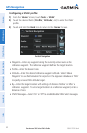

Garmin aera 500 Series Pilot’s Guide
190-01117-02 Rev. A
50
GPS Navigation
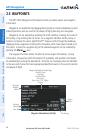
OverviewGPS NavigationFlight PlanningHazard AvoidanceAdditional FeaturesAppendicesIndex
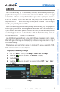
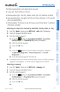
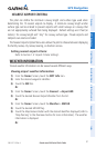
USR WPT (User Waypoints)• —name, bearing, and distance.
City• —name, bearing, and distance.
ARTCC (Air Route Traffic Control Center)• —bearing, distance, and frequency.
FSS (Flight Service Station)• —name, bearing, distance, frequency, and VOR (if
applicable).
Airspace• —name, time to entry (when applicable), and status.
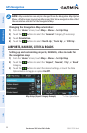
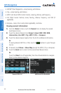
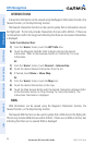
Viewing nearest information:
1)
From the ‘Home’ Screen, touch the Nearest Icon to display the second
level Nearest Icons.
2)
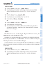
Touch the desired Nearest Icon (Airport, Airport WX, VOR, NDB,
Intersection, User WPT, City, ARTCC, FSS, or Airspace).
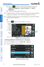
3)
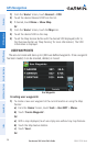
Touch the desired nearest option from the list for additional information.
Or
:
If viewing Nearest ARTCCs or FSSs, touch the buttons to cycle through
the list.
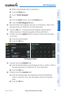
4)
If desired, touch Menu > Show Map (except for ARTCC, FSS, or Airspace).
5)
Touch the Back Icon to return to the second level Nearest Icons.
Or
:
Touch the Direct Icon (if applicable), then the Activate Button to navigate
Direct-to the selected waypoint.
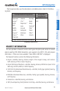
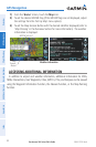
Nearest VORs List Additional VOR Information