


Garmin aera 500 Series Pilot’s Guide
190-01117-02 Rev. A
21
Overview
Overview GPS Navigation Flight Planning Hazard Avoidance Additional Features Appendices Index
➊
➋
➍
➌
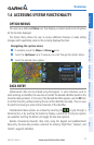
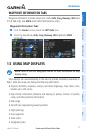
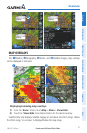
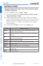
MAP OVERLAYS
The
➊
Weather,
➋
Topography,
➌
Terrain, and
➍
Satellite Imagery map overlays
can be displayed or removed.
➋
➌
➊
➍
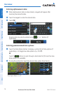
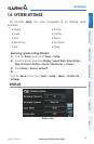
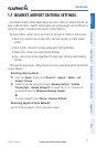
Displaying/removing map overlays:
1)
From the 'Home' Screen, touch Map > Menu > Show/Hide.
2)
Touch the 'Show/Hide' Data Option Button for the desired overlay.
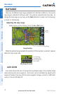
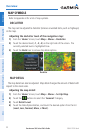
Satellite View only displays satellite imagery at and above the 20nm range. Below
the 20nm range, 'no sat view' is displayed below the map range.